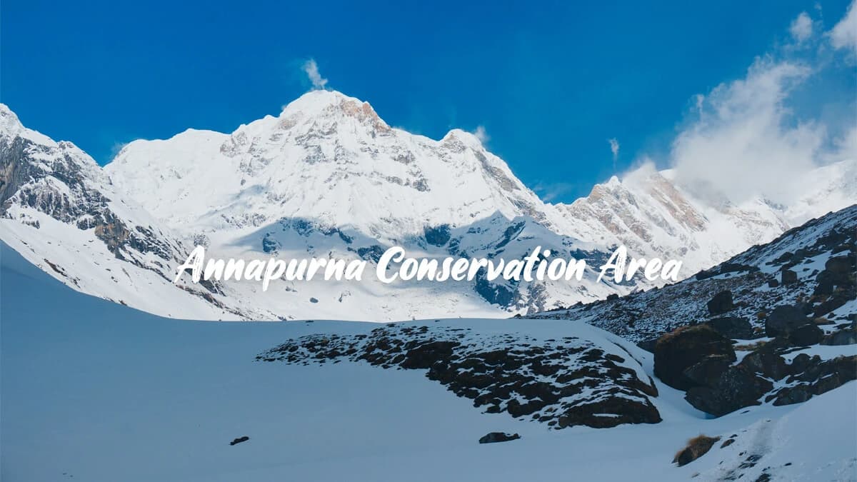
Nepal's Annapurna Conservation Area spans 7,629 km² over five districts with an elevation range of 790 meters to 8,091 meters. It is home to 1,226 plant species and 523 bird species and receives 270,000+ trekkers every year. Treks vary from easy 4-day treks to 21-days Annapurna Circuit treks over the 5,416-meter Thorong La.
Annapurna Conservation Area: The Ultimate Insider Guide
Every year, a staggering 270,000 trekkers visit the Annapurna Conservation Area, making it Nepal's most popular trekking point. The primary concerns of these trekkers include permit, altitude, and trail congestion. After assisting in over 200 treks within this region over the last decade, I can personally convey to you that their concerns are far from what is actually expected.
Trekking in Annapurna requires wading through outdated entry permit details, as well as contradictory reports on what time of year it's supposed to be. Offers not only up-to-date, first-hand information about these routes, but can clarify what exactly your Annapurna Conservation Area entrance includes, what trails suit your physical ability, and more.
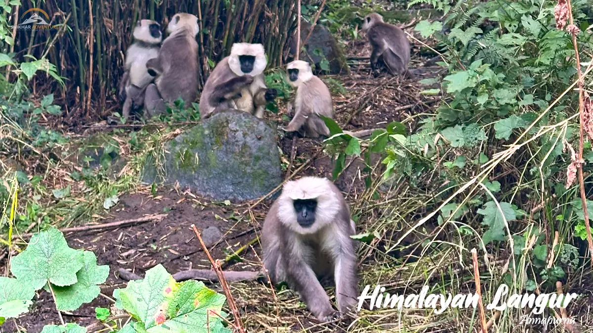
Himalayan Langurs spotted during Annapurna Base Camp Trek
Annapurna Conservation Area: What Is It?
Annapurna Conservation Area is the largest protected area in Nepal, covering 7,629 square kilometers. Established in 1986 and formally declared in 1992, Annapurna Conservation Area comprises five districts, which are Kaski, Lamjung, Manang, Mustang, and Myagdi.
Altitude varies from 790 meters in subtropical valleys to 8,091 meters on the summit of Annapurna I. This vertical range exceeds 7,000 meters.
Interesting Fact: The amount of elevation gain in the Annapurna Conservation Area, from the lowest point to the highest point (7,301 meters), is more than the elevation gain to the top of Denali, the highest peak in North America.
In contrast to Nepal's protected parks, about 100,000 inhabitants are living in and around the Annapurna Conservation Area. They have maintained their resource rights while involved in conservation.
ACA is managed by the National Trust for Nature Conservation through the Annapurna Conservation Area Project. This prevents the money from going to the central government in Kathmandu. Also, the village committee determines the policies on tourists and the spending on conservation.
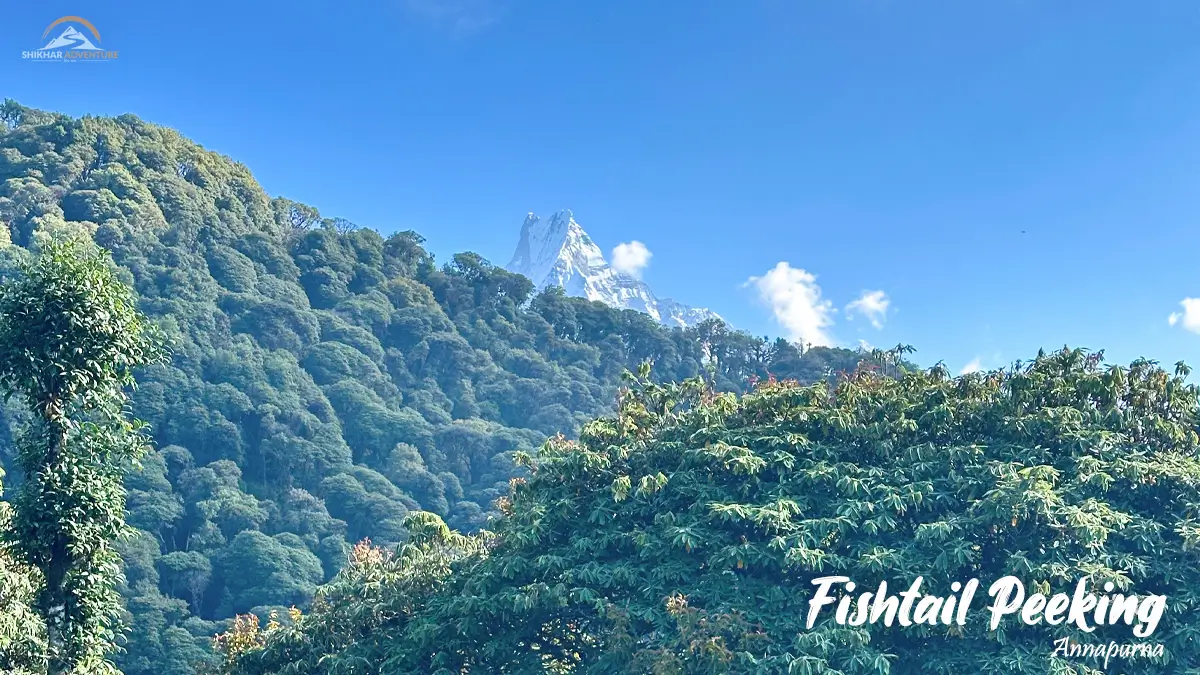
Fishtail peeking from behind the hills
Why Annapurna Differs From Other Regions?
Annapurna Region's mountain range is found at the crossroads of climatic zones. Southern parts receive more than 5,000 mm per annum of monsoon rain. Above the main Himalayan range, the rainfall reduces to 1,100 mm, forming rain-shadow deserts.
This makes for a remarkable degree of biodiversity. A two-week trek ranges from subtropical vegetation, through temperate forests, alpine meadows, and desert at high altitudes.
Kali Gandaki Gorge, which lies between Annapurna and Dhaulagiri, stretches around 5,500 meters in depth. It is the deepest valley in the world. Tilicho Lake has an altitude of 4,919 meters.
Interesting Fact: The Kali Gandaki gorge is so deep that three Burj Khalifas stacked on top of each other would not be able to touch the rim.
Infrastructural development is better than in regions like Dolpo and Kanchenjunga. There are teahouses for accommodation and eating. Mobile phones work in most of the villages. Yet the region remains authentically Nepali.
Biodiversity and Cultural Landscapes
The Annapurna Conservation Area has 1,226 flowering plant species. It has 105 mammalian, 523 bird, 40 reptilian, and 23 amphibian species.
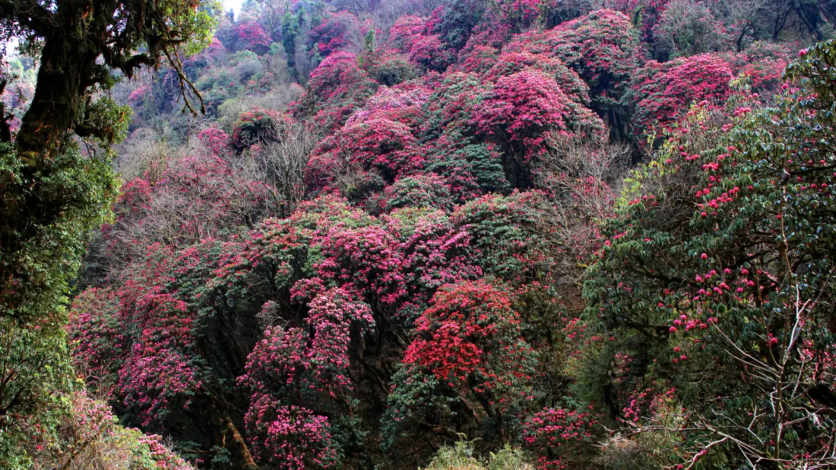
Rhododendrons blooming along the Ghorepani Poonhill Trail
Flora Zones
Subtropical belts below 1,000 meters are home to sal forests and chir pine. Temperate belts between 1,000 and 3,000 meters contain oak, rhododendron, and dense stands of bamboo groves.
Ghorepani's rhododendron forest area is the largest in Nepal and blooms red and pink in April. Mid-level forests are blue pine and hemlock.
Subalpine belts from 3,000-3,800 meters are dominated by birch and juniper scrub. Above 3,800 meters, alpine grasslands are predominant until plant life ceases at above 5,000 meters.
In the trans-Himalayan regions of Upper Mustang and Manang, the forests comprise scattered juniper and grasses tolerant of cold.
Wildlife
Snow leopards roam in high mountain ranges but are hardly seen. Their favorite quarry consists of Himalayan tahrs and blue sheep, known as bharal. Red pandas live in middle-elevation forests of rhododendron.
The Himalayan musk deer species has recovered after sustained hunting pressure over the decades. You will find langur monkeys around villages and spot Himalayan griffons soaring over gorges.
Higher bird diversity is found in the summer migration period. There are all six Himalayan pheasant species found in the Annapurna range, including both the endangered Cheer Pheasant and Satyr Tragopan.
The Spiny Babbler, found only in Nepal, inhabits dense thickets of undergrowth. Demoiselle cranes are seen during the autumn migration to India.
Interesting Fact: Snow leopards in the Annapurna range can jump as far as 15 meters horizontally to pursue their quarry on the mountainsides. This is equivalent to the length of a school bus.
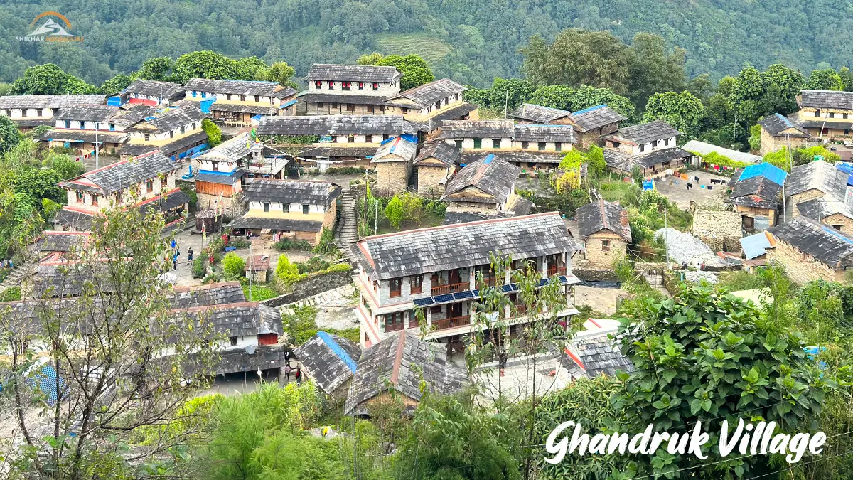
Ghandruk - Traditional Gurung village in Annapurna Conservation Area
Ethnic Communities
Gurung communities are prominent in the southern villages of Ghandruk, Landruk, and Chhomrong. Many elderly Gurung males have historical connections with British Gurkha regiments. Their houses are made of stone, carved wood, and slate roofs.
The Kali Gandaki valley is controlled by the Thakali people in villages of Marpha, Jomsom, and Tukuche. They made their wealth through trans-Himalayan trade of salt. They are known for an architectural style with white-washed walls and flat roofs with protected courtyards.
"Thakali" innkeepers serve the best "dalbhat" in all Nepal. They fully deserve this reputation.
People from the Manangi community living in the valley of the same name speak a language that is more similar to the language of the Tibetans than Nepali. Their traditional trade involved the transfer of yaks and grain across the passes.
Monasteries and chortens are found at higher elevations. Stone mani walls with Buddhist mantras are found on village approaches. Prayer flags are strung between passes and rivers.
Trekking Routes in Annapurna Conservation Area
Quick Route Comparison
Trek
Duration
Difficulty
Max Altitude
Best For
Annapurna Base Camp
7-10 days
Moderate
4,130m
First-time high-altitude trekkers
Annapurna Circuit
15-21 days
Challenging
5,416m
Experienced trekkers
Mardi Himal
5-7 days
Moderate-Challenging
4,500m
Those seeking fewer crowds
Ghorepani Poon Hill
4-5 days
Easy-Moderate
3,210m
Beginners, families
Upper Mustang
10-14 days
Moderate
3,840m
Culture enthusiasts
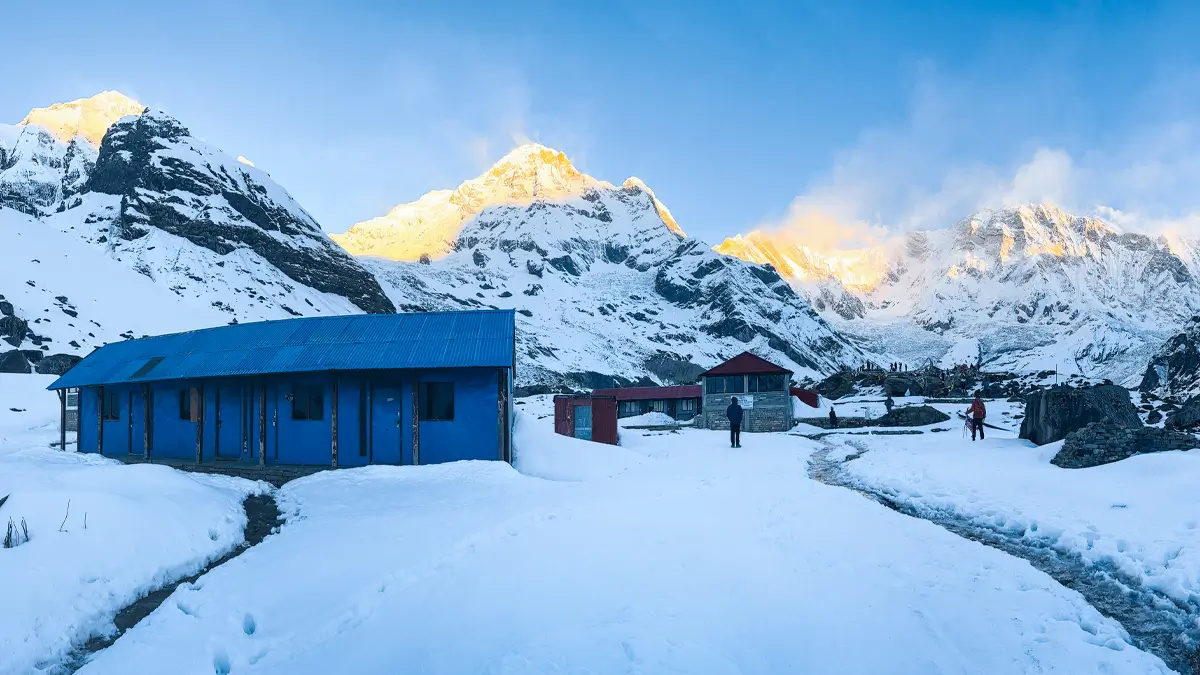
Trekking to Annapurna Base Camp with Himalayan views.
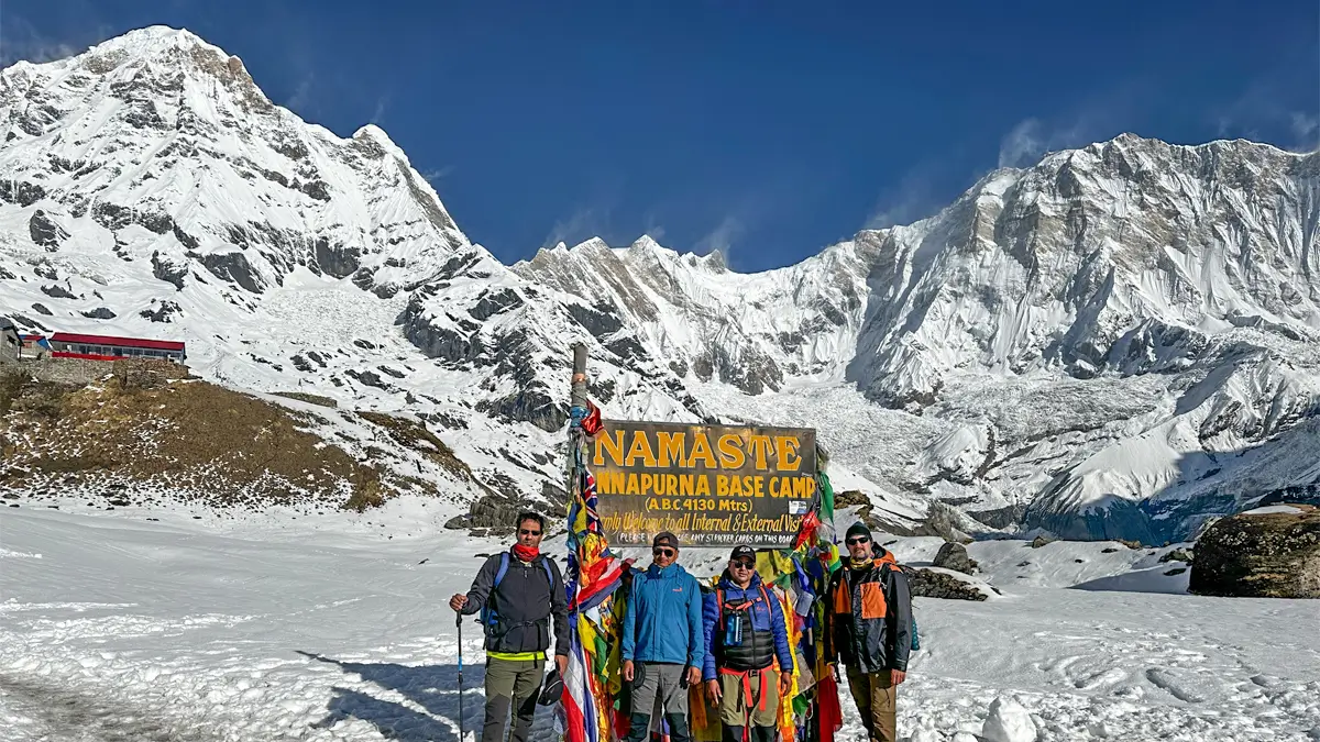
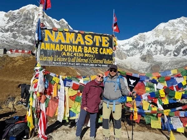
Annapurna Base Camp Trek
The ABC trek goes as high as 4,130 meters into a glacial theater ringed by seven peaks above 7,000 meters. The trek traverses the Modi Khola valley from agriculture land, through the forest and the gorges.
Difficulty Level: Moderate, with steady climbs.
Duration: 7-10 days from Pokhara, but usually 8 Days
Highest point: 4,130 meters
Best Time to Visit: Rhododendron (March to May). Bright skies (October to November). Cold yet possible climatic conditions (December to February). Avoid Monsoon seasons (June-September)
Best For: Hikers seeking spectacular views, but not high elevation. Families with teenagers.
Insider Tip: A sunset at Machapuchare Base Camp beats the sunrise at ABC for views. Stone steps from Sinuwa to Deurali will destroy your knees on the descent; trekking poles essential. Plastic water bottles were banned in Chhomrong in 2019, so pack a water purification system/tablets.
Interesting Fact: Machapuchare, which means "Fish Tail" (6,993m), has never been climbed. It remains one of the most iconic unclimbed peaks around the globe. In 1957, a British expedition almost reached the top, within 150 meters, but refrained from climbing it out of respect.
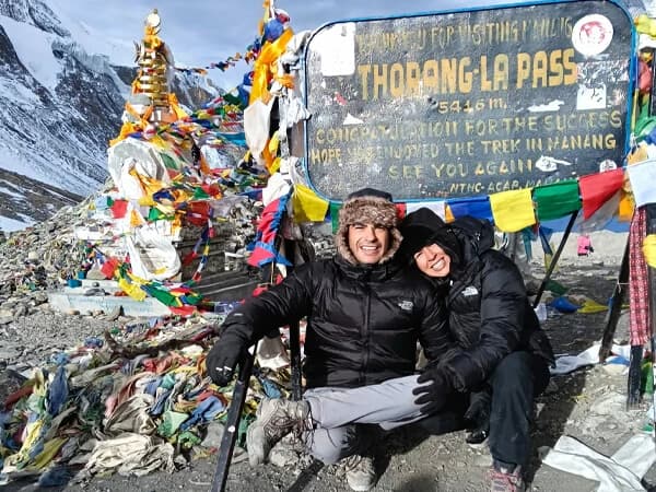
Thorong La Pass, high Himalayan mountain pass on Annapurna Circuit
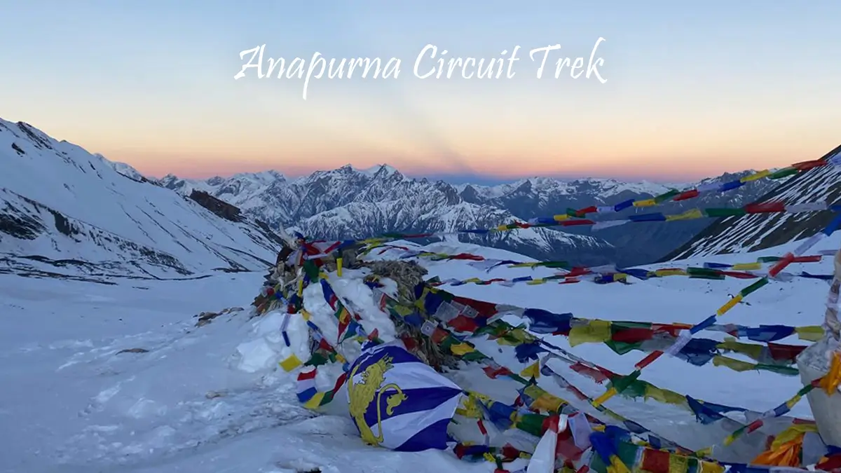
Annapurna Circuit Trek
The Annapurna circuit encircles the Annapurna massif, going through the pass of Thorong La at 5,416 meters above sea level. Annapurna's reputation as a trekking destination was earned after this trail opened in 1970s.
Difficulty: Challenging because of high altitude at Thorong La.
Date: 15-21 days, depending on the departure point and the acclimatization strategy
Maximum Altitude: 5,416 meters at Thorong La pass.
Best Season: October-November has the best weather. March-May works, but there are afternoon clouds, which restrict viewing of the mountains. The winter season in December, January, and February has extreme cold, which can, at times, close Thorong La due to snow.
Best For: Experienced trekkers accustomed to high altitudes. People looking for an experience with varied culture and topography.
Insider Info: The road works have changed the classic route. Many trekkers now trek from Besisahar to Chame, bypassing days at lower altitudes. It cuts acclimatization time to a dangerous level. It is advised to begin either from Besisahar or Bhulbhule to tackle lower altitude treks correctly.
The eastern flank of Thorong La (going up) is easier than the other side (descending). An additional day of acclimatization is necessary in the Manang valley.
Before Thorong La, conditions are abject: cold, congestion, no facilities. Thorong Phedi is a viable alternative for those fit enough for a long summit day.
Interesting fact: The Annapurna Circuit route follows the Kali Gandaki valley, where people extract shaligram, sacred fossils of ammonites that date back 140 million years. These fossils confirm that the Himalayas were once beneath the Tethys Ocean.
Mountain landscapes on the Mardi Himal Trek
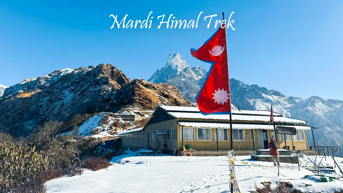
Mardi Himal Trek
Mardi Himal is the newest major route in the Annapurna range and was opened in 2012. The route attains an altitude of 4,500 meters at the base camp beneath the southern face of Mardi Himal.
Difficulty level: Moderate to challenging. Shorter than ABC, but steeper sections, higher maximum altitude.
Duration: 5-7 days from Pokhara
Maximum Altitude: 4,500 meters at Mardi Himal Base Camp.
Best Time: October/November and March-May. There is heavy snowfall in winter above 3,500 meters.
Best for: Trekkers seeking less crowds compared to the popular ABC. Time-constrained trekkers seeking altitude experience.
Insider Tip: Mardi Himal receives fewer trekkers compared to ABC and the circuit. Tea house quality is also variable, with some of them very good and some quite simple. The ridge walk between Low Camp and High Camp is stunning, with strong wind factors.
The view of Machapuchare's eastern side rivals anything found in Nepal. The sunrise view of this part of Annapurna is simply spectacular.
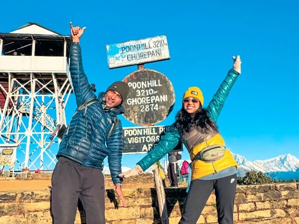
Sunrise view from Poon Hill, Ghorepani Trek
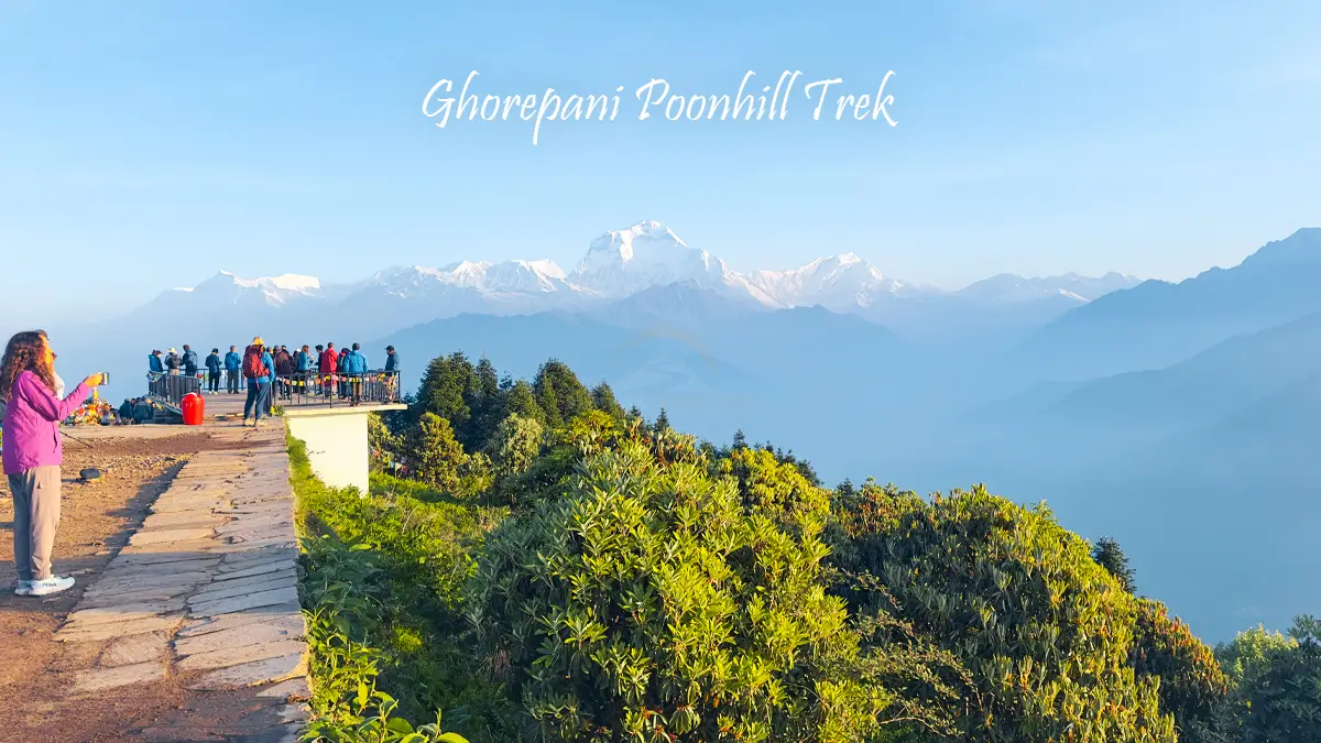
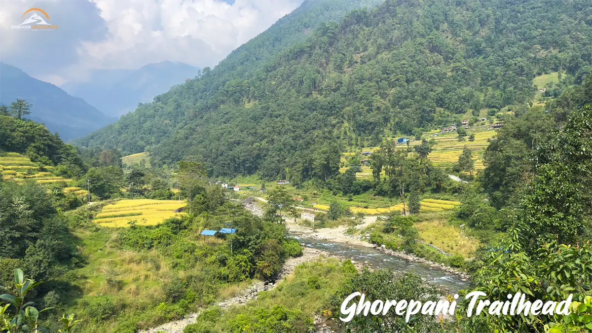
Ghorepani Poon Hill Trek
This trek goes up to Poon Hill at an altitude of 3,210 meters. This is one of the most easily accessible trekking routes of Annapurna and is perfect for beginners.
Difficulty level: Easy/Moderate. Trails are well-marked and easy to follow, and the
Duration: 4-5 days from Pokhara
Maximum Altitude: 3,210 m at Poon Hill.
Best Time to Visit: October to November (clear views of Himalayas). Early March to May (rhododendrons in bloom). Possible throughout the year except heavy season.
Recommended For: Beginner trekkers. Families with kids. People with limited time or limited fitness.
Insider Tip: Wake up at 4:30 AM for Poon Hill Sunrise, which, yes, can be very crowded, but it's worth it. It will take 45 minutes from Ghorepani village.
Rhododendron forests from Ulleri to Ghorepani are at their height around early April. It is also the time when the maximum number of trekkers come here.
Think of continuing to Ghandruk village rather than getting back via Nayapul. Ghandruk has better cultural experiences and a Gurung museum.
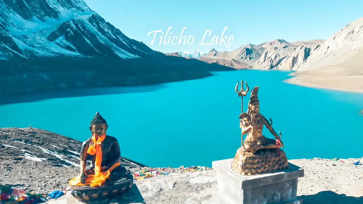
Turquoise waters of Tilicho Lake in the Himalayas
Tilicho Lake
Tilicho Lake sits at an altitude of 4,919 meters, thus being among the highest in the world. This is an excursion off the Annapurna Circuit.
Duration: Add 2-3 days on the circuit route.
Maximum Altitude – 4,919 meters/5,416 meters on Thorong La Pass
Insider's Tip: The weather in Tilicho can be unpredictable even during peak months. The lake tends to be frozen till as late as May. The route to the lake from Tilicho Base Camp can be exposed; thus, it's not advisable during the afternoon, especially when there are wind and/or poor visibility conditions.
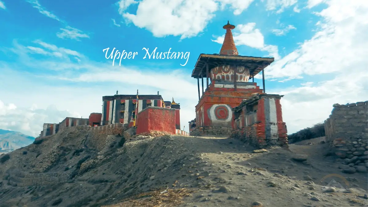
Barren landscapes and traditional villages of Upper Mustang
Upper Mustang
Upper Mustang requires a Restricted Area Permit for entry. Upper Mustang is a preserve of Tibetan culture from the ancient Kingdom of Lo.
Trekking Time: 10-14 days from
Permit Cost: 50 USD per day (Updated for 2026).
Best Time to Visit: April to October. Upper Mustang is in rain shadow, so it's the best place to trek during monsoon.
Insider Tip: Upper Mustang is very culturally interesting, but naturally less scenic than the other Annapurna treks. You are essentially paying for cultural virgin territory and high altitude deserts, not mountain scenery.
Permits And Logistics
Annapurna Conservation Area Project (ACAP) Permit
ACAP permit is necessary for all trekkers to Annapurna. This permit currently costs NPR 1,000 for SAARC citizens, while for foreigners, it is NPR 3,000 (approximately USD 22 in 2026).
Get permits in Kathmandu from Nepal Tourism Board or in Pokhara from the office of ACAP. Carry two photos and the actual passport.
Some trekking companies offer the permit as a package. Check that this service is offered.
ACAP Permit: NPR 1000 for SAARC nationals & NPR 3,000 (~ USD 22) for foreigners
Upper Mustang Permit: USD 50 per day - Restricted Area
TIMS Card: Not required yet
Documents required: Passport, 2 passport photos/digital copies for those processed by Registered Company.
TIMS Card
Requirements regarding the Trekkers' Information Management System card have also changed several times. As of 2026, TIMS is no longer required for treks inside the Annapurna Conservation Area, though TAAN has asked the govt. to make it mandatory.
Transportation
Most of the treks into Annapurna begin in Pokhara. Pokhara is 200 kilometers west of Kathmandu and takes 7-8 hours by tourist bus, 8-9 hours by local transport, and 25 minutes by flight.
Tourist buses are NPR 1000 to 2,000. Flights are USD 85 to 120.
Trailhead Transportation from Pokhara:
Destination
Duration
Cost (NPR)
Trek Starting Point
Nayapul
1.5 hours
500-800
ABC, Ghorepani Poon Hill
Besisahar
5-6 hours
800-1,200
Annapurna Circuit
Jomsom (Flight)
20 minutes
USD 100-130
Upper Mustang, Circuit (reverse)
Kande
45 minutes
400-600
Mardi Himal
Rain affects the roads during monsoons. You should factor in delays.
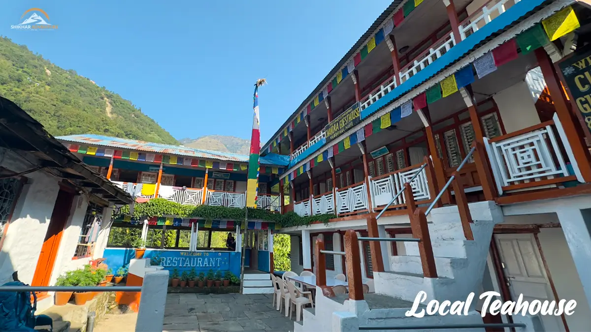
Local teahouse along the Ghorepani Poonhill Trail
Accommodation
Teahouses offer lodging along all trekking trails in Annapurna Conservation Area. They are family-run and have private rooms that share bathrooms.
Room rates are from NPR 200-500 (USD1.50-4) a night. As elevation increases, so does cost. Some lodges provide a stay for free if you consume meals at the lodging.
Basic facilities can be expected: thin mattresses, no heating (apart from dining room stoves), squat or Western toilets, washing with cold water. Hot showers are possible from NPR 200 to NPR 400 at some lodges.
Reservation: Not required, except in peak times (October to November, April). Your guide will provide arrangements for the accommodation every day.
Budget Breakdown
Budget Trek (Independent): 25-35 USD per day
Accommodation: USD 3-5
Three meals: USD 15-20
Snacks/drinks: USD 3-5
Permits: One-time cost
"Mid-Range Trek": USD 35-50 per day,
Includes guide/porter wages
Improved lodges and food
Some gear rental if needed
Organized Package: 800-1500 USD
Includes permits, guide, porter, accommodation, and most meals.
Transportation from Pokhara
Duration dependent
The prices go up with altitude. A meal of dal bhat will cost you between NPR 400-500 in the lower villages but NPR 700-900 at Annapurna Base Camp.
Interesting Fact: A bottle of Coca-Cola at Annapurna Base Camp costs NPR 500 (USD 3), which is 10 times more than in Pokhara. All commodities beyond 3,000 meters have to be carried by porters, which sometimes takes 6-8 hours.
The price of bottled water also goes up. Bring water purification tablets/filter.
Packing Essentials
Clothing: Layering system for base, insulating, and waterproof outer layers.
Temperatures: 25°C at lower elevations and -15°C at high altitudes.
Essential Gear Checklist:
Hiking boots (ankle support required) – broken-in
Sleeping bag designed for -10°C for high routes
Trekking poles (knee protection essential)
Headlamp with additional batteries
Sunglasses (UV400 minimum)
SPF 50+ Sunscreen
Water purification (tablets and filter)
First Aid Kit including altitude medication
Power bank (charging not reliable above 3,000m
Clothing Layers:
Base layer (Merino wool or synthetic)
Insulation layer (fleece or down jacket)
Waterproof shell jacket and pants
Warm hat, sun hat, gloves
3-4 pairs of moisture-wicking socks
Footwear: Hiking boots with ankle support broken in. Trail shoes are acceptable only for Ghorepani Poon Hill trek.
First Aid: Altitude sickness drugs (Diamox), pain relievers, blister care, basic antibiotics, water purification.
Porters will carry the heavier bags weighing up to 25 kg. Daypacks need to be light, carrying water, snacks, camera, and layers.
Safety and Responsible Trekking
Altitude Awareness
The main health risk for people above 3,000 meters is Acute Mountain Sickness, also known as "AMS". It includes symptoms of a headache, nausea, tiredness, and dizziness.
To prevent, proper acclimatization procedures must be followed. Climb no more than 500 meters above 3,000 meters. Rest days must be included with every 1,000 meters of ascent.
Altitude Sickness: Warning Signs:
Mild AMS: Headaches, nausea, dizziness, fatigue, loss of appetite
Moderate AMS: Severe headache, vomiting, weakness, shortness of breath at rest
The traditional route of Annapurna Circuit involves acclimatization by design. ABC and Mardi Himal Treks involve a slower pace.
Diamox (acetazolamide) assists in the prevention of AMS. The dosage regimen is 125mg twice a day starting one day prior to entering the high-altitude region.
If AMS worsens while at rest, descend immediately. Altitude sickness can rapidly advance to HACE or HAPE, which can be fatal.
Interesting Fact: The atmospheric oxygen level at the Thorong La pass (5,416m) is only 50% that of the oxygen found at sea level. To adjust to this, your breathing rate and production of red blood cells increase, which takes several days.
Weather and Seasonal Risks
October-November conditions are most stable: sunny weather, pleasant average temperatures, excellent views. There are warmer months: March-May, with clouded peaks in the afternoons.
Winters (Dec-Feb) see harsh cold conditions above 3,500 meters. Thorong La Pass can be closed because of snow. Lower routes such as Ghorepani are open.
"Monsoon season" (June through September) indicates leeches at altitudes under 2,000 meters, muddy trails, and poor views in the mountains. Upper Mustang is the only area that is optimized for monsoon season trekking, as it lies in rain shadow area.
Weather is very unpredictable in mountains. Always carry waterproof equipment.
Guide and Porter Factors
Annapurna Conservation Area doesn't require guides, trails are marked, and directions are available from teahouses.
However, guides have several advantages:
Cultural interpretation and language assistance
Navigation during adverse weather conditions
Recognizing Altitude Sickness
Emergency response capability
Supporting local employment
Your important luggage is carried by porters. This is more convenient because your treks will be strengthened. Moreover, you will be able to sightsee.
Fair Wages and Treatment:
Guides: 25-35 USD per day
Porters: USD 20-30 per day
Rates include food & accommodation
Maximum load on porters: 25 kg (two trekker bags)
Provide proper gear: warm clothing, good footwear
Ensure insurance coverage
Ethical employment practices would include proper equipment (clothing, footwear), feasible loads (no more than 25kg), and insurance coverage.
Waste management
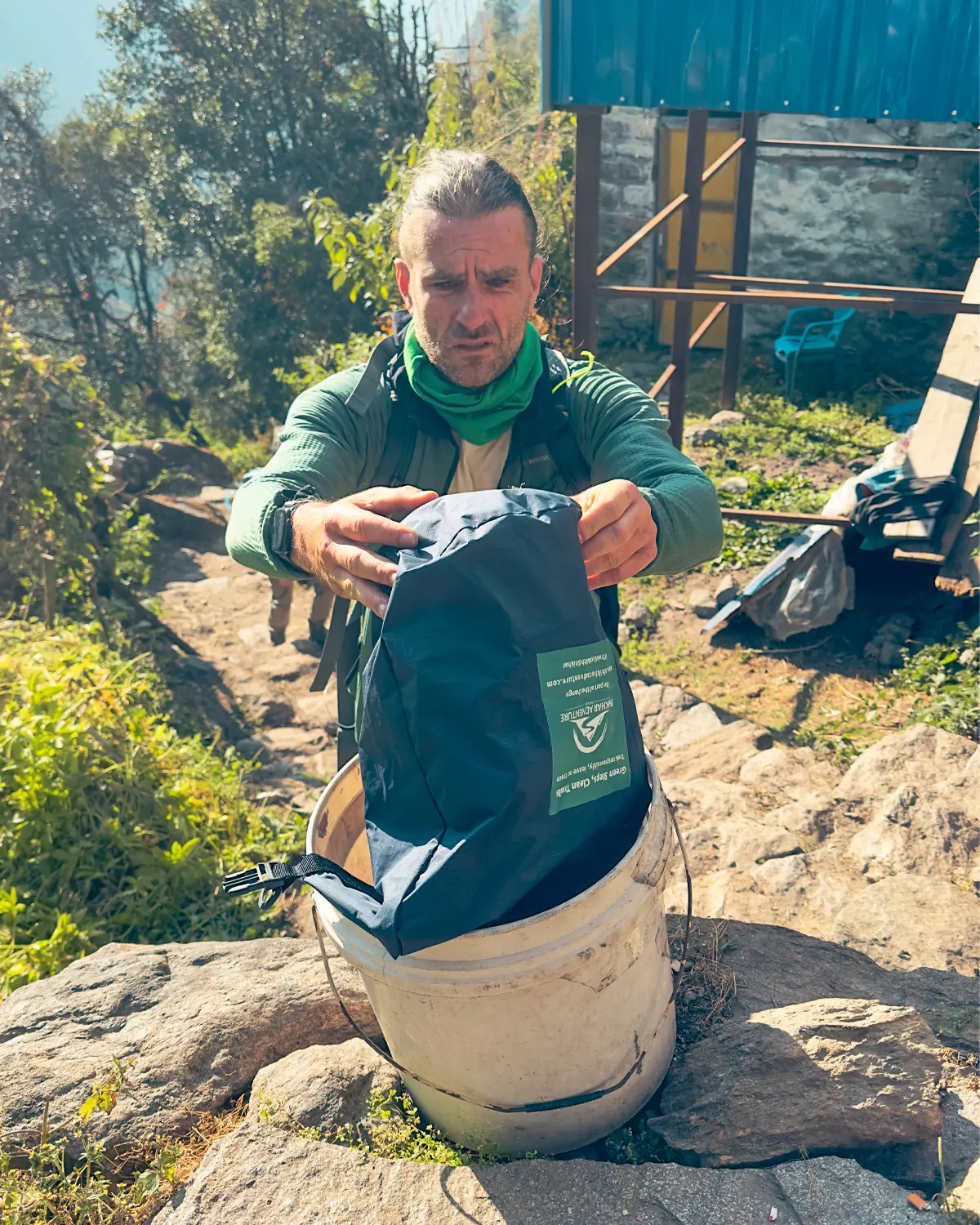
Annapurna Conservation Area produces huge waste through trekking. Currently, plastic bottle usage is banned in some village locations, and trekkers are required to carry water vessels and purification agents.
Dispose of all non-biodegradable waste. Batteries, packaging, and toiletries, for example, have to go back to Pokhara for disposal.
Use lodge toilets only. Do not defecate near water or trails.
Some teahouses compost their food wastes. Others burn their trash, leading to air pollution. Reduce, re-use, and avoid excess packing.
Supporting Local Communities
The cost of your permit helps support conservation and development projects directly. ACAP dollars pay for school, health post, micro-hydro projects, and trail work.
Eating dal bhat promotes local farming. Components of dal bhat are sourced from local farmland; pasta and pizzas are imports.
Buy handicrafts directly from village cooperatives. There are Gurung communities such as Ghandruk that sell cloths and wooden objects.
Tipping of guides and porters is expected. Suggested tipping: per guide for a two-week trek, USD 120 - 150, per porter, USD 100 - 150.
There are certain photography manners worth noting. One must always seek permission before taking photos of people, and even more so in monasteries in
Conservation Success
The Annapurna Conservation Area is a pioneering example of community-based conservation worldwide. Resource management is done by local committees, not by a centralized government.
Output includes protected wildlife, reforested areas, and sustainable tourism infrastructure. Snow leopard populations are stabilized, despite the growing presence of humans.
Community-controlled forests offer sustainable wood fuel. More lodges are using solar energy and kerosene rather than wood fires.
Interesting fact: The Annapurna Conservation Area model has been replicated in more than 30 countries around the world. The success of the model showed that it is always better to involve communities in protection than to keep them away from it.
However, there are still difficulties. Glaciers are melting at 8.5% since 2000. The trash management network cannot meet the rise in tourism.
Your responsible trekking helps to support conservation efforts directly.
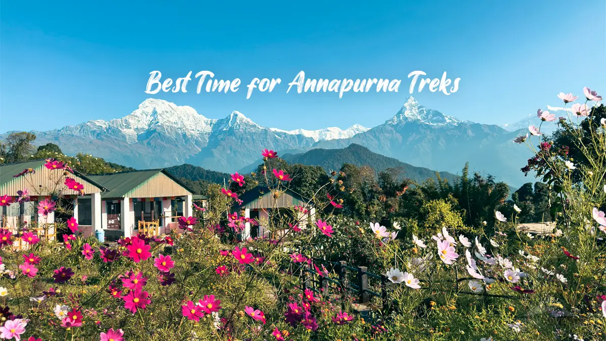
Best time for trekking in Annapurna Conservation Area
Best Time to Visit Annapurna Conservation Area
Season Comparison Table
Season
Weather
Visibility
Crowds
Temperature Range
Autumn (Sep-Nov)
Stable, clear
Excellent
High
15-20°C (day) / 5-10°C (night)
Spring (Mar-May)
Warming, afternoon clouds
Good mornings
Moderate-High
20-25°C (day) / 10-15°C (night)
Winter (Dec-Feb)
Cold, dry
Clear but hazy
Low
10-15°C (day) / -5 to 0°C (night)
Monsoon (Jun-Aug)
Heavy rain below 3,000m
Poor
Very low
25-30°C (day) / 15-20°C (night)
Autumn (September–November)
Weather: Sunny, with calm conditions, and cool mornings and pleasant afternoons.
Visibility: Excellent mountain views. Air is clean and crisp after the monsoons.
Crowds: The peak months are when there are the most trekkers. Teahouses are full in early October
Nature: Green slopes after monsoon rains. Golden harvests in the rice terraces.
Recommendation: Best overall season for all routes. Book your air tickets and, if possible, your accommodations at popular places like Ghorepani.
Spring (March–May)
Weather: Rising temperatures, more unstable conditions. Evenings are warm.
Visibility: Visibility in the morning can be very good. clouding by midday.
Crowds: Second-busiest time of the year, specially April.
Landscape: Rhododendron trees bloom magnificently in this region. The low valleys are
Recommendation: Suitable for flower lovers. ABC and lower trails are preferable over high trails where cloud coverage obstructs views.
Winter (December- February)
Weather: Cold, particularly at higher altitudes. Clear skies but very adverse weather over 4,000 meters.
Visibility: Mountain views, clear on calm days.
Crowds: Fewer trekkers except Christmas & New Year.
Landscape: Snowcapped passes. The lower forests are drying and turning brown.
Recommendation: Only experienced trekkers on the high tracks. Ghorepani Poon Hill treks are possible and scenic. The Thorong La pass may be closed by snow.
Monsoon(June-August)
Weather: Heavy rain below 3,000 meters. Leeches below 2,000 meters
Suggestion: Skip the standard route. Mustang is best in monsoon season as it is in rain shadow.
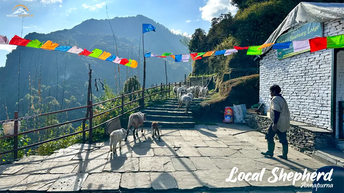
Shepherd herding sheeps in Annapurna Area
Frequently Asked Questions
How safe is Annapurna Conservation Area for beginners?
Yes, treks such as Ghorepani Poon Hill, and easier parts of ABC, are beginner-friendly treks. These can be accomplished by those who are moderately fit, and acclimatization can be achieved in a proper manner.
What is the cost of trekking in Annapurna?
Budget independent trekking: USD 25-35 per day, including accommodation and meals. Organized packages: USD 800-1,500 in total, depending on the trek and its length. Permits: An extra USD 30-40 charge.
Do I require a guide in Annapurna Conservation Area?
Guides, while not obligatory, are very useful, as they include information about altitude sickness, cultural understanding, and emergency assistance. Trekking alone is feasible on well-marked trails in high season, if one has previous trekking experience.
What level of fitness is required?
Physical requirements differ for different routes. Ghorepani Poon Hill requires a basic level of fitness, 4-5 hours a day. ABC and Mardi Himal treks require a good level of fitness, 6-7 hours a day. Then, Annapurna Circuit requires an excellent level for 7-8 hours a day at high altitude.
What is the most beginner-friendly Annapurna trek?
Ghorepani Poon Hill Trek provides a perfect introduction with moderate height, very good trekking infrastructure, and stunning scenery. This trek helps in gaining self-confidence without intimidating effort. Add Ghandruk for an immersion experience.
How does Annapurna compare to Everest region?
Annapurna has more cultural and natural diversity with easier access and a lower cost of travel. Altitude and peaks are steeper on Everest but involve flying to Lukla. Annapurna is easier to reach and not so harsh.
When should I book my Annapurna trek?
October-November requires booking 2-3 months in advance. Peak season. April-May requires 1-2 months of advance booking. Winter and monsoon season allows last-minute bookings. Flights to international destinations like Nepal must be booked in advance.
Begin Your Annapurna Journey
The Annapurna Conservation Area is not only Nepal's most successful protected area model, but treks here suit trekkers of all abilities. During your journey, you will observe ecological belts ranging from tropical to alpine, learn about villagers keeping alive their long-standing cultures, and directly contribute to sustainable developments.
Watching the sunrise at Annapurna Base Camp is an experience that alters people. Reaching the peak is only one aspect, and realizing the impact of conservation, cultures, and adventure is another.
Local expert: Our local team has supported trekkers on these routes for over a decade. We know where to find the best dal bhat, what acclimatization strategies are most effective, and how to coordinate your trek to optimize mountain views with minimal crowds.
Contact Us
Get genuine advice according to your level of fitness, dates, and trekking objectives. There is no obligation, but local knowledge and sincere suggestions about how to do the Annapurna Conservation Area trek.