Mount Manaslu is the eighth-highest mountain on Earth, standing 8,163 meters above sea level. Climbers call it the "Killer Mountain" because of a brutal early history of avalanches, though its overall death rate actually sits below Annapurna I's. Most people who visit never touch the summit at all — they walk the Manaslu Circuit instead, a 10 to 17 day teahouse trek that circles the mountain and crosses the 5,106-meter Larkya La Pass without any technical climbing.
Where Is Mount Manaslu Located?
Mount Manaslu is located in Nepal's Gorkha District, Gandaki Province, in the west-central Himalayas.
It sits in the Mansiri Himal range at 8,163 meters (26,781 ft). The summit lies roughly 64 km (40 miles) east of Annapurna and about 160 km (100 miles) northwest of Kathmandu, near the Tibet border.
The peak lies at approximately 28.55°N, 84.56°E, within the Manaslu Conservation Area, a protected zone established in 1998 that spans the trekking route from subtropical valleys to alpine desert near the Tibetan plateau.
The nearest major access points are Kathmandu, the usual starting city, and Machha Khola or Soti Khola, the standard trailheads. Getting there takes an 8- to 9-hour jeep or bus ride along the Budhi Gandaki valley.
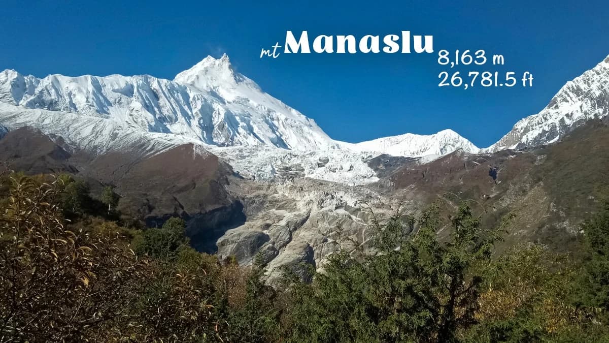
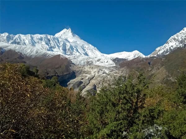
Mount Manaslu seen from Shyala village
What Does the Name Manaslu Mean?
Manaslu comes from the Sanskrit word manasa, meaning "soul" or "intellect." That's why the mountain is sometimes called the "Mountain of the Spirit", a name that reflects its deep significance to the Tibetan Buddhist communities living in its shadow.
First climbers: Toshio Imanishi (Japan) and Gyalzen Norbu (Nepal), part of a Japanese expedition
Trekking route length: Roughly 150–177 km depending on where you start and finish
Highest point on the circuit: Larkya La Pass, 5,106 m
Biodiversity: Around 33 mammal species, over 110 bird species, and roughly 2,000 species of flowering plants across the conservation area
Why Is Manaslu Called the Killer Mountain?
Manaslu is called the "Killer Mountain" because of an unusually high number of climbing deaths relative to successful summits, driven mainly by avalanches on its exposed upper slopes.
The 1972 Avalanche That Started the Nickname
In 1972, an avalanche tore through a Korean expedition's camp and killed around 15 people — one of the deadliest single incidents in Himalayan mountaineering history at the time. That disaster is largely why the nickname stuck.
More Recent Deadly Incidents
It hasn't been an isolated case, either. A 2012 avalanche near Camp 3 killed 11 climbers during a single summit push. In September 2022, American ski-mountaineer Hilaree Nelson died after triggering a small avalanche while skiing down from the summit, a loss that made international headlines and reminded the climbing world how quickly conditions can turn here.
The Real Numbers Behind the Nickname
Mountaineering records show somewhere around 85 to 90 climber deaths against a little over 2,000 successful summits since 1956. Depending on which dataset you use and which year it's calculated from, that puts Manaslu's fatality-to-summit ratio anywhere from roughly 4% up to nearly 18%. Older records tend to skew higher because there were fewer summits to divide against.
Avalanches cause the majority of these deaths, not falls or altitude sickness. That's a function of the route's terrain, particularly the exposed slopes below the summit ridge.
How Manaslu Compares to Other 8,000-Meter Peaks
Annapurna I has historically carried a much worse ratio, with some older records showing roughly one death for every five successful summits. So "Killer Mountain" is fair, but Manaslu isn't the single deadliest 8,000-meter peak in the world. Better forecasting, fixed rope systems, and more disciplined expedition planning have made recent decades noticeably safer than the 1970s were.
Climbing the Summit vs. Trekking the Circuit
One distinction gets lost in a lot of online writing about this mountain: summiting Manaslu itself is a serious technical mountaineering undertaking. Trekking the Manaslu Circuit, which is what almost everyone reading this is actually planning, involves zero technical climbing. You're walking, not climbing, and the risks are entirely different.
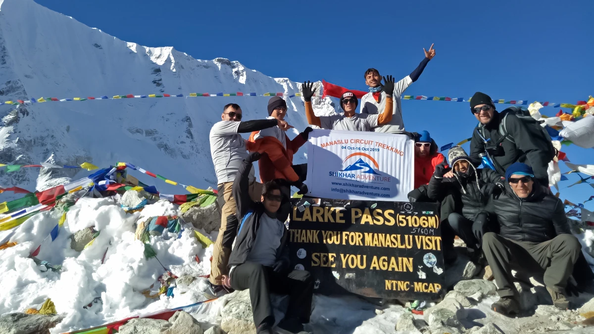
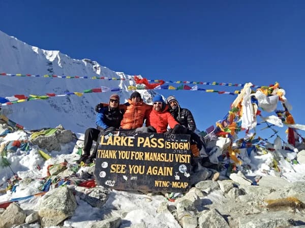
Larkya La Pass on the Manaslu Circuit Trek
The Manaslu Circuit Trek: A First-Hand Account
No technical skills required here — just decent legs, some patience with altitude, and a willingness to be uncomfortable for a few days near the pass.
Machha Khola to Jagat: Into the Restricted Zone
We began in Machha Khola, reached after an eight- to nine-hour jeep ride from Kathmandu on a road that constantly forgets it's a road.
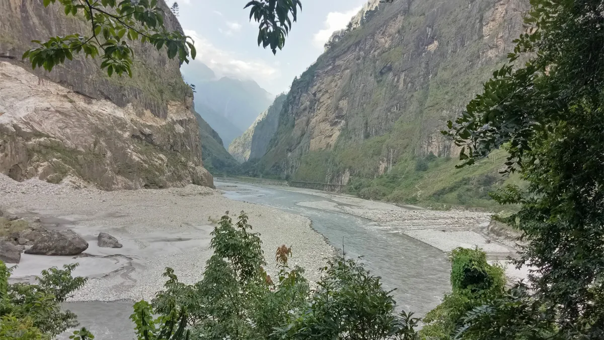
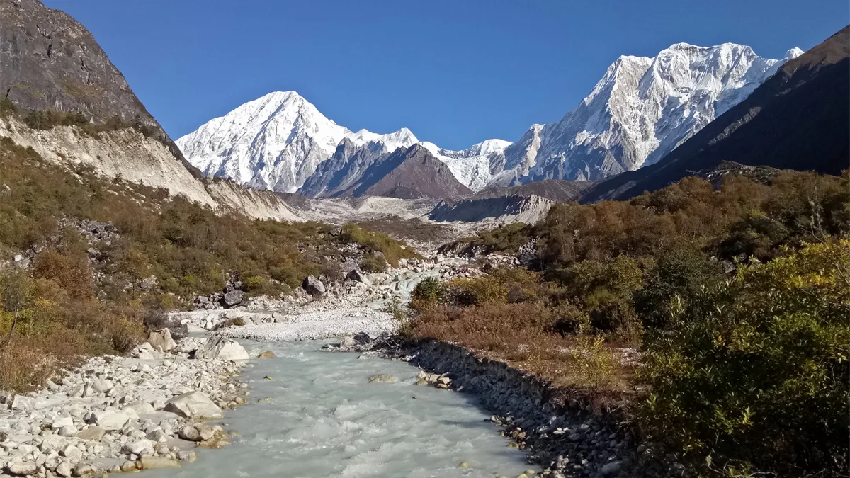
The Budhi Gandaki valley starts low, humid, and sweaty. Swinging suspension bridges cross a turquoise-grey glacial river, past terraced fields and Gurung villages that feel barely touched by tourism.
By Jagat, on day two or three, permits get checked for the first time. It genuinely feels like entering a restricted zone that most travelers never see. The valley narrows here, waterfalls drop straight down cliff faces beside the trail, and river crossings start multiplying by the hour.
Machha Khola to Jagat trail, Manaslu Circuit
Namrung to Lho: First Sight of Manaslu
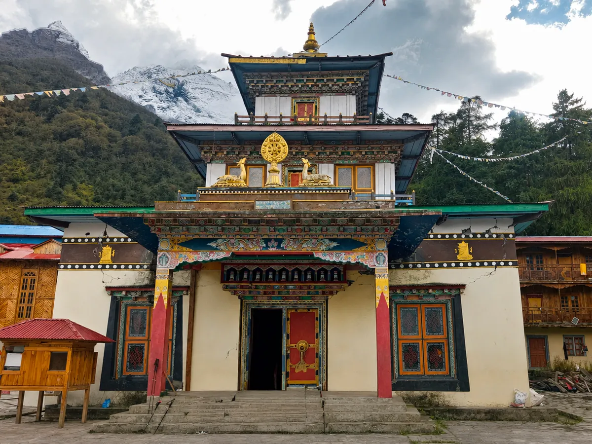
Namrung shifts the entire mood of the trek. The forest changes character, the air gets thinner, and mani walls and chortens start appearing along the path — small signs that you're entering a different cultural zone.
Then, at Lho, Manaslu breaks above the treeline for the first time. After days of walking beneath it unseen, the mountain suddenly fills the sky without warning. The trail beneath your feet feels genuinely small next to it.
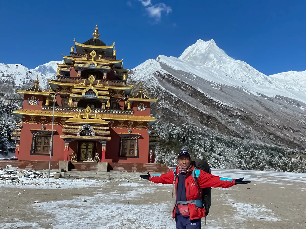
Ribum Monastery, Lho village
Samagaon: Rest Day and Base Camp
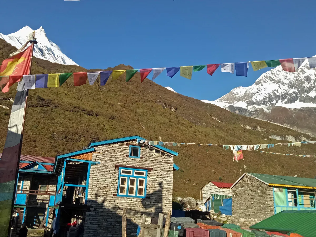
Samagaon sits around 3,500 meters, and most itineraries schedule a rest day here for acclimatization. Nobody actually rests, though.
Almost every trekker uses the day to hike up toward Manaslu Base Camp instead. Tents cluster on the moraine where mountaineers prep for summit pushes, while Birendra Lake sits ice-blue directly beneath the glacier — worth the extra hours on tired legs.
The air thins noticeably at this point. Skip water and you'll likely get a headache within hours, an early and very real warning sign of altitude sickness.
Samagaon village, Manaslu Circuit Trek
Samdo and Dharamsala: The Final Approach
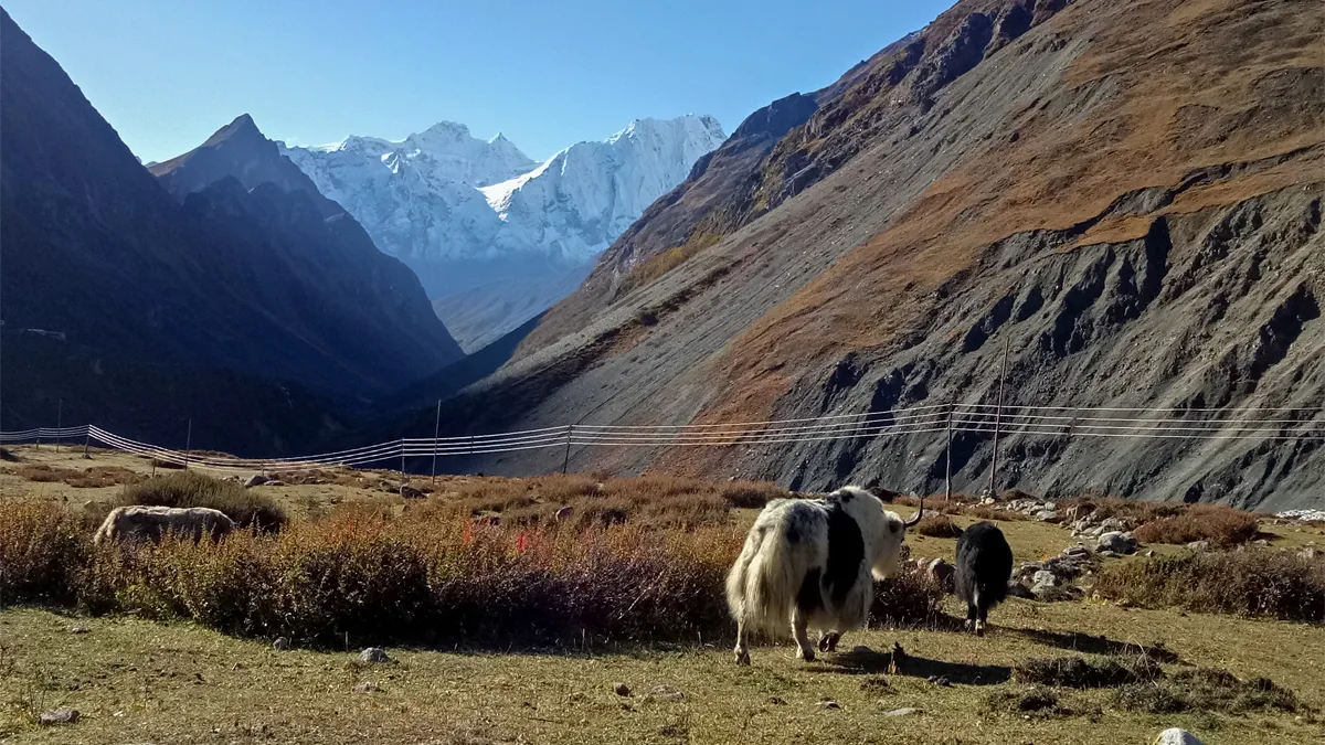
Samdo is the last village before the Tibetan border, only a few kilometers off. Trees disappear entirely here. Stone houses, yak pastures, and this thin, piercing light take over instead.
Sleep gets genuinely difficult at this altitude — a common and expected symptom, not a sign that anything's gone wrong.
The next stop, Dharamsala (also called Larkya Phedi), has a handful of stone shelters and nothing else, no village at all. Most trekkers eat early, climb into their sleeping bags by 7 p.m., and lie awake listening to the wind before the pass crossing the next morning.
Samdo to Dharmashala trail, Manaslu Circuit
Crossing Larkya La Pass
The pass crossing usually starts around 3 a.m., climbing by headlamp in genuinely freezing darkness. Nobody talks much at this point. The air is thin enough that even slow, steady walking feels like real exertion.
Then the sun comes up mid-climb, and the whole glacier turns pink and gold at once. The tiredness stops mattering, at least for a few minutes.
Larkya La sits at 5,106 meters, prayer flags snapping hard in the wind, with a 360-degree wall of peaks on the horizon — Himlung, Cheo Himal, Kang Guru, and Annapurna II all visible at once.
Nobody lingers long up there; it's bitterly cold and there's no shelter. But standing there, wrecked and genuinely awed at the same time, is basically the whole trek distilled into one moment.
Descent Through Bimthang to the Annapurna Side
Bimthang brings green, vibrant terrain back into view almost immediately. The first dal bhat at lower altitude tastes like the best meal you've had in weeks.
The descent turns out to be nearly as hard as the climb up — steep, loose underfoot, and relentless on the knees for hours. After that comes a long walk down through rhododendron forest into the Annapurna region.
Reaching a road again feels strangely abrupt, like the mountain handed you back to the ordinary world without checking whether you were actually ready for it.
Manaslu Circuit Trek, Annapurna side descent
How Long Does the Manaslu Circuit Trek Take?
A standard teahouse trek runs 10 to 14 days on the trail itself, with most full itineraries spanning 10 to 17 days once you add travel and acclimatization days at either end.
A typical breakdown looks something like this: two to three days getting from Kathmandu to Jagat, three to four days climbing through Namrung and Lho to Samagaon, a rest day at Samagaon, two days pushing on to Dharamsala via Samdo, the pass-crossing day into Bimthang, and two to three days descending to the roadhead on the Annapurna side.
Add the sacred Tsum Valley as a side trip, and the whole trip stretches out to roughly 20 days. It's a worthwhile detour if you have the time — Tsum sees a fraction of the traffic Manaslu itself gets.
How Difficult Is the Manaslu Circuit Trek?
The Manaslu Circuit trek is rated moderately to strenuously difficult. Long daily walking hours, high-altitude acclimatization, and the Larkya La crossing above 5,000 meters are what drive that rating up.
You don't need technical climbing skills for any of it. What you do need is solid cardiovascular fitness and, ideally, some prior multi-day trekking experience before you commit to this one.
Training and Fitness Tips
Start building hiking stamina at least two months out if you can. Regular cardio, stair climbing with a loaded pack, and a few multi-hour hikes on hilly terrain go a long way toward making Larkya La feel manageable rather than brutal.
What to Pack
Layering matters more than any single "best" jacket. You'll want a warm down jacket, a windproof shell, thermal base layers, sturdy broken-in boots, trekking poles for the descents, a good sleeping bag rated to at least −15°C for the higher villages, and a headlamp for the pre-dawn pass crossing. Water purification tablets or a filter are worth carrying too, since bottled water gets expensive and wasteful the higher you climb.
Altitude Sickness: What Trekkers Should Know
Acute Mountain Sickness, or AMS, is the most common health risk on this route, especially in the stretch between Samagaon and the Larkya La crossing.
Watch for headache, nausea, dizziness, and disrupted sleep. Ascending slowly, drinking more water than feels necessary, and actually using the scheduled acclimatization days all cut the risk substantially.
If symptoms get worse rather than better, the only real answer is to descend, not push on. Licensed guides on this route are trained to recognize AMS early and will usually insist on turning back before it becomes dangerous — trust that judgment even if it's frustrating in the moment.
Permits Required for the Manaslu Circuit
The Manaslu region sits in a sensitive border zone, so unpermitted, fully independent trekking isn't an option here. You'll need three permits, plus one local fee.
Manaslu Restricted Area Permit (RAP): roughly USD 100 per person for the first week in autumn (September–November), or USD 75 per week in the off-season, with a per-day surcharge after the first seven days.
Manaslu Conservation Area Permit (MCAP): a flat USD 30 (about NPR 3,000) for foreign nationals, regardless of season.
Annapurna Conservation Area Permit (ACAP): also USD 30, required because the circuit exits through Dharapani, inside Annapurna Conservation Area territory.
Chum Nubri Rural Municipality fee: a small local charge, roughly NPR 1,000, collected on the trail near Jagat.
For a standard 14-day circuit, total permit costs generally land somewhere between USD 215 and 265, depending on season and exactly how many days you spend inside the restricted zone. Guide and porter fees, food, and accommodation come on top of that.
All of these permits must be processed through a government-registered trekking agency — it isn't optional paperwork, and checkpoints along the trail (Jagat, Philim, Namrung, Samagaon, and Dharapani) will turn you back without them.
Can You Trek Manaslu Without a Guide?
No. Fully independent trekking without a licensed guide isn't permitted in any of Nepal's restricted areas, Manaslu included.
What did change: in March 2026, Nepal's Department of Immigration dropped the old rule requiring a minimum of two trekkers per restricted-area permit. Before that, a solo traveler either had to find a partner or pay for a second "ghost" permit just to qualify.
Now a single trekker can apply for the Manaslu RAP on their own, through a registered agency, as long as a licensed guide comes along. Under the current rules, one guide can accompany up to seven trekkers on a single permit. The guide requirement itself hasn't budged — it's the group-size rule that disappeared.
Culture, Flora, and Fauna of the Manaslu Region
The Manaslu Conservation Area is one of Nepal's most biodiverse protected zones, home to roughly 33 mammal species and more than 110 species of birds. Musk deer, snow leopards, red pandas, and Himalayan tahr all live within its boundaries, though sightings of the more elusive species are rare.
Vegetation shifts fast with elevation. Rhododendron and pine forest dominate the lower valleys, and by the time you reach Samagaon it's given way almost entirely to alpine meadow and glacial rock.
Tibetan Buddhism shapes daily life across the upper Nubri and Tsum valleys in a way that's hard to overstate. Centuries-old monasteries, mani walls, and prayer flag-lined paths run through nearly every village above Namrung.
Permit fees aren't just a formality, either — they fund real infrastructure in these remote settlements, including healthcare posts, schools, and monastery restoration work. Trekking here has a tangible community benefit that goes beyond the personal experience of the trail itself.
Best Time to Trek the Manaslu Circuit
Autumn (September to November) and spring (March to May) offer the clearest skies and most stable weather on this route, and most trekkers plan around these two windows.
Winter dumps heavy snow at Larkya La, often closing the pass entirely for weeks at a time. Monsoon season (June to August) brings leeches on the lower trail, landslide risk on the exposed sections, and clouds that hide the mountain views you came for.
Manaslu Circuit vs. Other Nepal Treks
Trekkers comparing options often weigh Manaslu against Nepal's more established routes, and the differences are worth knowing before you commit.
The Manaslu Circuit sees far fewer trekkers than the Everest Base Camp Trek or the Annapurna Circuit, which means more solitude and a stronger sense of untouched culture on the trail.
It's also more remote, with fewer teahouse comforts and stricter permit requirements than either alternative — you're trading convenience for authenticity here. Trekkers weighing routes may want to compare it against the Annapurna Circuit Trek or the classic Everest Base Camp Trek for a fuller picture of Nepal's major teahouse treks before deciding.
Frequently Asked Questions
How tall is Mount Manaslu?
8,163 meters (26,781 ft), which makes it the eighth-highest mountain on Earth.
Where exactly is Manaslu located?
In the Mansiri Himal range, Gorkha District, west-central Nepal — about 64 km east of Annapurna.
Do I need a permit to trek the Manaslu Circuit?
Yes, three of them: the Restricted Area Permit, the Manaslu Conservation Area Permit, and the Annapurna Conservation Area Permit. All three go through a registered trekking agency.
Roughly what does the whole trek cost?
Permits alone run about USD 215–265 for a standard 14-day circuit. Add guide fees (typically $25–35 a day), porter costs, food, and teahouse lodging, and total budgets usually land somewhere in the $1,200–2,800 range depending on group size and comfort level.
Can I do this trek without a guide?
No — a licensed guide from a registered agency is mandatory throughout, even after the March 2026 rule change removed the old two-person group minimum.
When should I go?
Autumn (September–November) and spring (March–May) give you the best weather and visibility. Avoid winter and monsoon if you can help it.
Is the Manaslu Circuit hard?
Moderately to strenuously difficult, mostly because of altitude and the Larkya La crossing above 5,000 meters. No technical climbing skill is needed, but decent fitness matters.
Who climbed Manaslu first?
Toshio Imanishi and Gyalzen Norbu, on May 9, 1956, as part of a Japanese expedition.
Is Manaslu actually more dangerous than Everest?
Its fatality-to-summit ratio has historically run higher than Everest's, though it's generally lower than Annapurna I's. It's a genuinely risky peak to summit, without being the single deadliest 8,000-meter mountain.
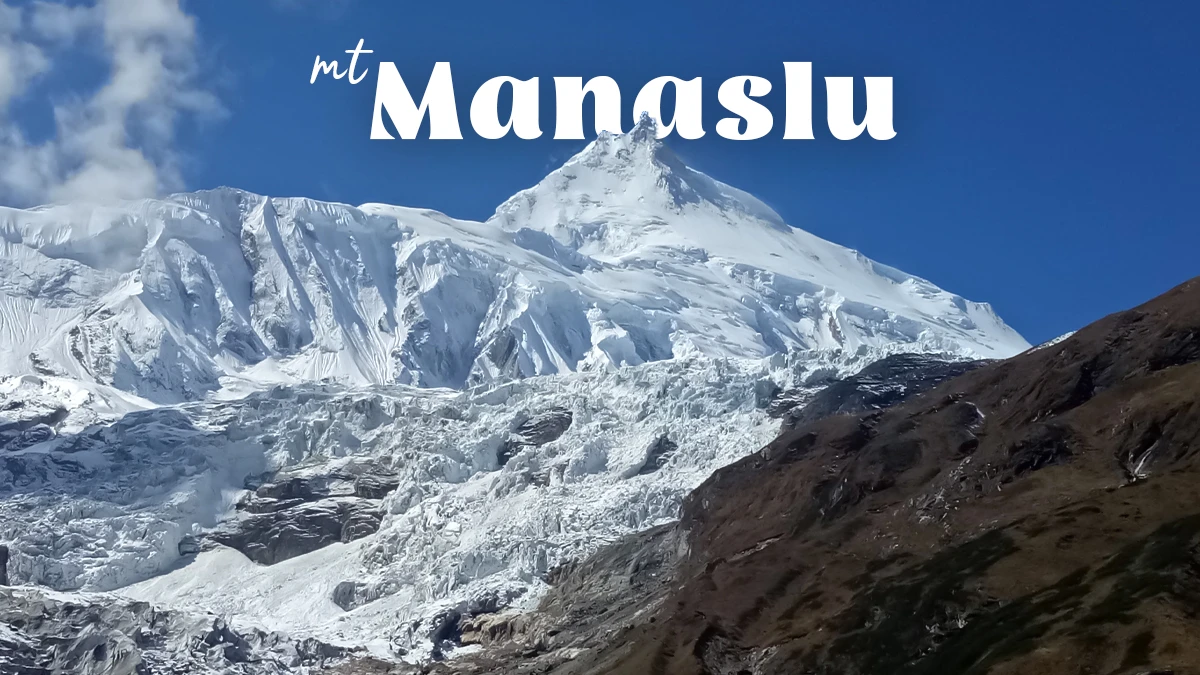
Mount Manaslu, known as the Killer Mountain
Conclusion: A Mountain That Demands Respect
Mount Manaslu earns its nicknames honestly. As the "Killer Mountain", it carries a real history of avalanches and lost climbers, one that deserves genuine caution rather than hype.
As the "Mountain of the Spirit", it remains sacred to Tibetan Buddhist communities who've lived in its shadow for generations, surrounded by monasteries, prayer flags, and mani walls that predate any trekking permit system.
At 8,163 meters, Manaslu doesn't need to compete with Everest for attention. Its quieter circuit trail offers solitude and a kind of remoteness that Everest largely lost decades ago.
Standing at Larkya La, cold and worn out, looking out at Himlung and Annapurna II, it's easy to understand why trekkers keep coming back to a mountain with this reputation.
It isn't an easy peak, and it isn't an easy trek either. It asks for preparation, patience, and a bit of humility. In return, it offers something increasingly rare in the Himalaya: a place where the mountain still feels bigger than the people trying to cross it.