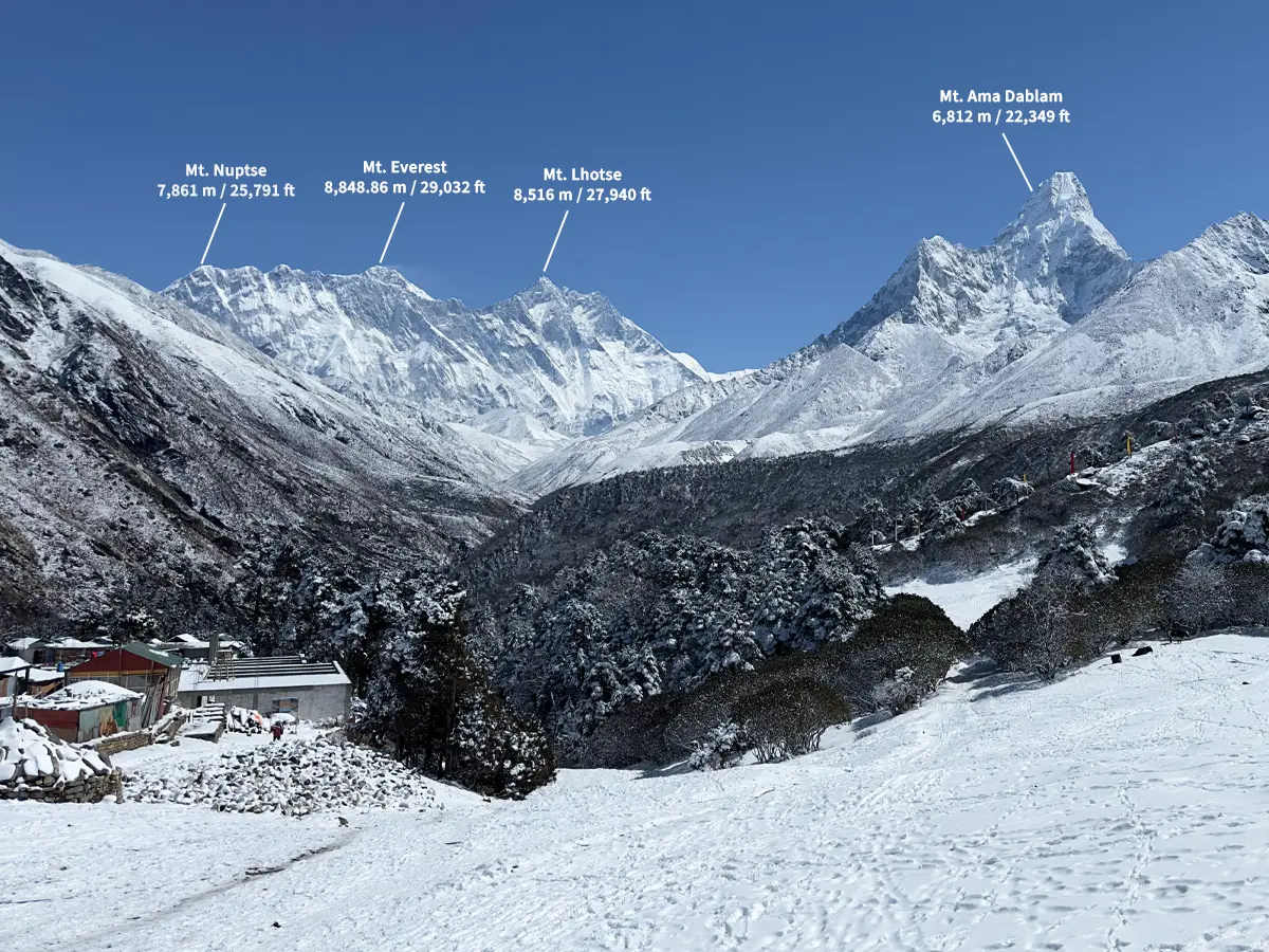
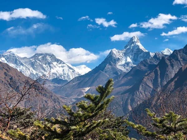
Sagarmatha National Park is a UNESCO World Heritage Site located in the Khumbu region of Nepal that preserves Mount Everest and the surrounding Himalayan ecology. Established in 1976, Sagarmatha National Park covers 1,148 km², stretching from 2,845 m to the 8,849 m summit of Mount Everest. It is home to snow leopards, red pandas, and traditional Sherpa settlements, including Namche Bazaar and Tengboche.
What Is Sagarmatha National Park?
Few places on the planet compress this much drama into so little space. Sagarmatha National Park, established in 1976 under Nepal's National Parks and Wildlife Conservation Act, sits in the Solukhumbu district of eastern Nepal, right in the heart of the Khumbu. Three years later, UNESCO gave it World Heritage status, the first natural site in Nepal to earn that title, largely because of its towering peaks, its glaciers, and an ecosystem that exists nowhere else on Earth.
A few numbers tell you why:
Area: 1,148 square kilometers, plus a 275-square-kilometer buffer zone added in 2002
Elevation range: 2,845 m to 8,849 m (9,334 ft to 29,032 ft), the summit of Mount Everest
Borders: Makalu Barun National Park to the east, the Qomolangma National Nature Preserve in Tibet to the north, and the Dudh Koshi River to the south
Home to: Mount Everest, the Khumbu Glacier, the Gokyo Lakes, and Sherpa villages including Namche Bazaar and Tengboche
Inside those borders you'll find soaring mountains, glacial rivers, alpine forest, and Sherpa settlements that have stood for centuries, all crammed into one of the steepest elevation ranges of any national park anywhere.
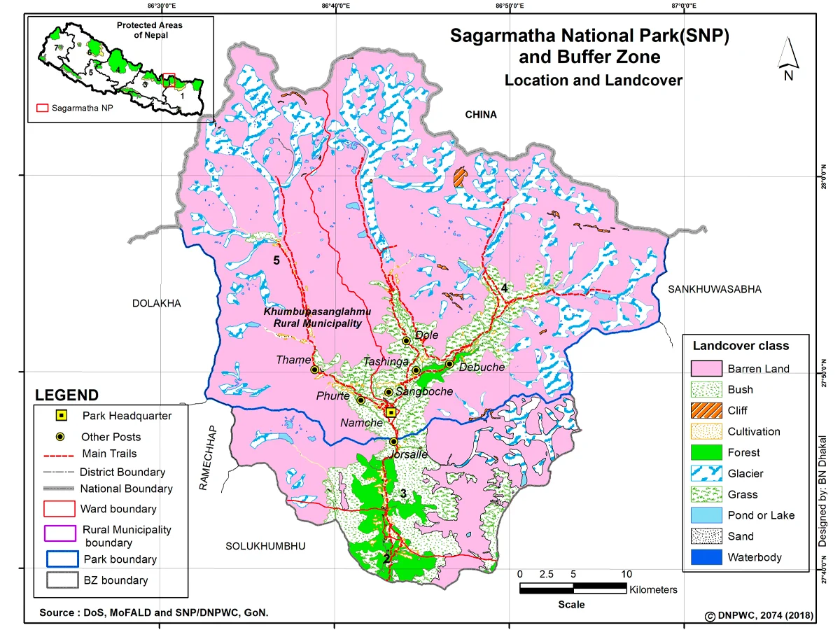
You'll find the park in the Khumbu region of Solukhumbu district, about 140 kilometers (87 miles) northeast of Kathmandu as the crow flies. Getting there is another matter. Most visitors fly into Lukla and walk the rest of the way, because no road reaches the park boundary.
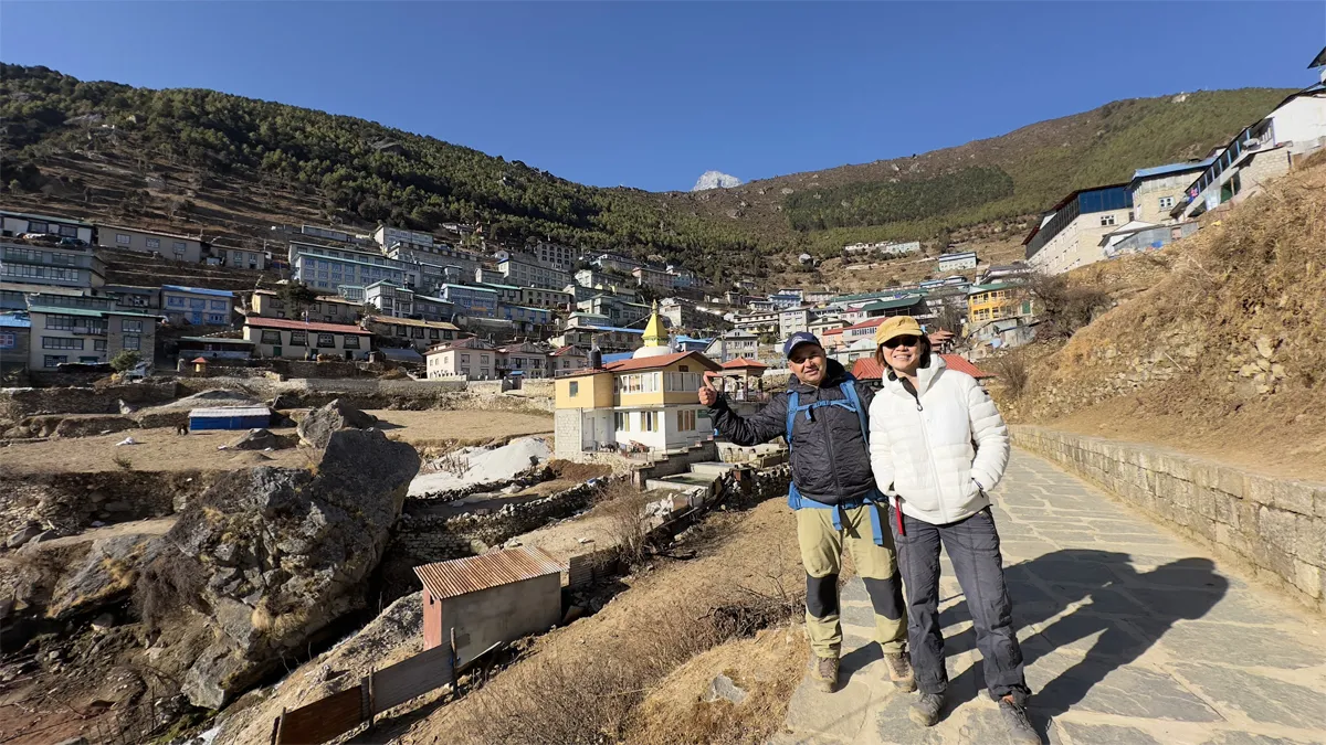
Namche Bazaar acts as the gateway. It's the park headquarters and the largest Sherpa town around, and just about everyone heading deeper into the Khumbu, whether trekker, researcher, or trader, passes through it first.
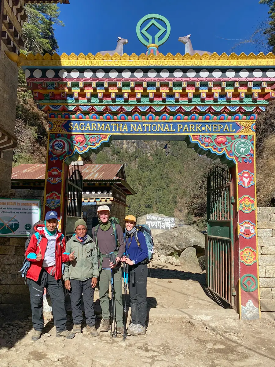
Sagarmatha National Park entrance gate
Why Was Sagarmatha National Park Established?
By the 1960s and 70s, a steady rise in visitors was putting real strain on the forests and grazing land around Everest. Nepal responded in 1976 by creating the park, aiming to protect the alpine environment before deforestation and tourism pressure went too far.
What made the approach work wasn't just the conservation rules. It was the decision to let Sherpa residents keep living there, farming and grazing livestock as they always had. That balance between strict protection and local livelihoods turned into something of a template, one that other conservation efforts across the Himalayas have tried to follow since.
Geography and Elevation Zones
Walk from the park's lowest edge at 2,845 meters to the summit of Everest at 8,849 meters, and you'll pass through a handful of completely different worlds. Each elevation band has its own climate, its own plants, and its own animals, which is part of what makes the park such a rich place to study, or simply to walk through.
Elevation Zone
Altitude Range
Characteristics
Forest Zone
2,845 m – 3,500 m
Pine, fir, and rhododendron forest; most Sherpa villages sit here
Sub-Alpine Zone
3,500 m – 4,000 m
Birch and juniper shrubland; thinning tree cover
Alpine Zone
4,000 m – 5,000 m
Open meadows, scrub, and grazing pasture; last stretch of vegetation
Nival Zone
Above 5,000 m
Rock, snow, and glacier; little to no vegetation
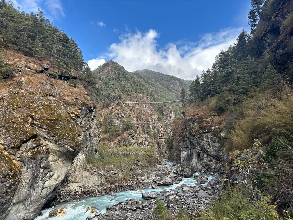
Dudh Koshi River along the Everest trekking trail
Rivers and Glaciers
The Dudh Koshi River owes its existence to glacial meltwater, and it repays the favor by carving straight through the Khumbu valley and marking the park's southern edge. Locals named it well: Dudh Koshi means "milk river," a fitting description of its pale, silty color.
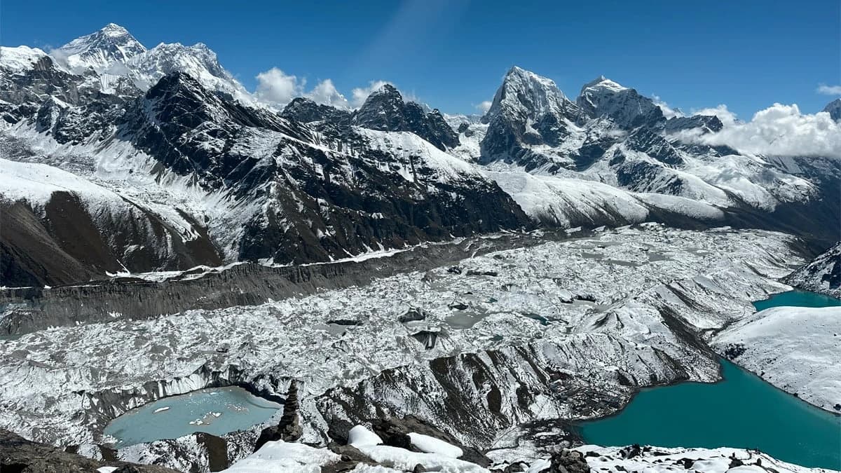
Above it sits the Khumbu Glacier, one of the highest glaciers anywhere, spilling down from Everest's slopes and forming the notoriously unstable Khumbu Icefall, a stretch every EBC trekker eventually hears about. Head west toward Gokyo and you'll find the Ngozumpa Glacier, Nepal's largest, feeding the turquoise lakes that draw photographers from around the world.
Climate and Weather
Weather here doesn't wait around. It shifts fast, both with elevation and with the season. Down in the lower villages, conditions stay fairly mild most of the year, but climb toward the passes and peaks and you're back in snow and cold no matter the month.
Season
Months
Conditions
Spring
March – May
Mild days, clear mountain views, rhododendrons in bloom
Summer / Monsoon
June – August
Heavy rain, cloud cover, limited visibility
Autumn
September – November
Stable weather, the clearest mountain views of the year
Winter
December – February
Cold temperatures, snow at higher elevations, fewer visitors
Flora of Sagarmatha National Park
Gain a few hundred meters and the vegetation changes on you. Below 3,500 meters, blue pine, fir, and rhododendron blanket the hillsides, giving the lower Khumbu its green, forested feel. Push higher and the trees give way to tough juniper and birch shrubs, until, past 5,000 meters, there's barely anything left besides lichen and moss clinging to bare rock.
Plant
Typical Elevation
Rhododendron
2,800 m – 3,500 m
Blue Pine and Fir
2,800 m – 3,500 m
Himalayan Birch
3,500 m – 4,000 m
Juniper
3,500 m – 4,500 m
Alpine Grasses and Lichen
Above 4,500 m
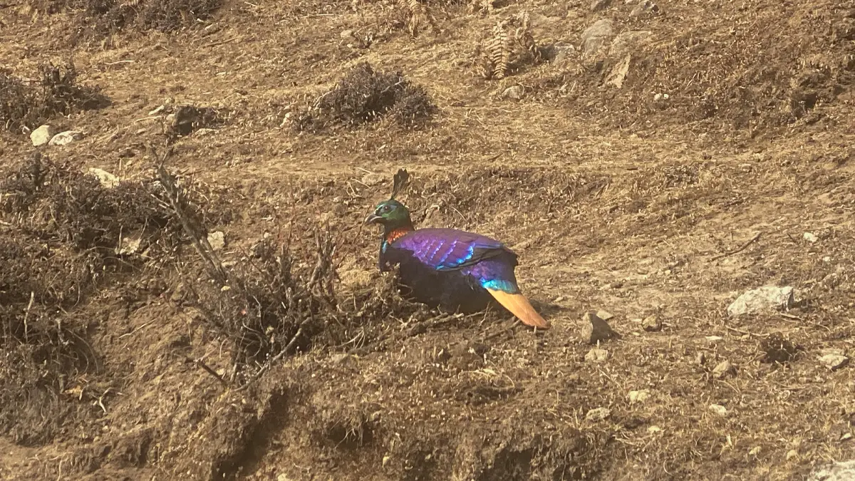
Himalayan Monal spotted in Sagarmatha National Park
Fauna of Sagarmatha National Park
Some of the world's rarest cold-adapted species call this park home, though seeing them is another story. Most stay hidden in the rocky, high-altitude terrain, so spotting one usually rewards patience over luck.
Animal
Notes
Snow Leopard
Elusive big cat; the park's most iconic and endangered predator
Red Panda
Found in lower forested zones; rarely seen
Himalayan Tahr
Wild goat species common on steep, rocky slopes
Himalayan Black Bear
Lives in the forested lower elevations
Musk Deer
Small, shy deer found in forest and shrub zones
Himalayan Monal
Nepal's colorful national bird; found in forested areas
And that's just the headline species. Altogether, the park supports more than 118 bird species and over 30 mammal species, which makes it one of the richest biodiversity pockets anywhere in the high Himalayas.
Sherpa Culture Inside the Park
This isn't an empty wilderness. The Sherpa people live here, and their villages, monasteries, and traditions shape daily life across the Khumbu. Unlike a lot of strictly protected parks, Sagarmatha lets residents farm, graze livestock, and run the teahouses that keep trekkers fed and warm.
Namche Bazaar, Khumjung, Pangboche, and Tengboche stand out as the best-known Sherpa villages. Walk through any of them and you'll pass prayer flags fluttering over the trail, mani stones stacked along the path, and monasteries, Tengboche among the most important, still very much alive with daily Buddhist practice.
Major Attractions in Sagarmatha National Park
Attraction
Highlight
Mount Everest
The world's tallest peak at 8,849 m; the park's centerpiece
Everest Base Camp
Sits at about 5,364 m; the park's most visited destination
Namche Bazaar
Historic Sherpa trading town and the park's headquarters
Tengboche Monastery
The largest and most important monastery in the Khumbu
Gokyo Lakes
Six turquoise glacial lakes fed by the Ngozumpa Glacier
Khumbu Glacier
One of the highest glaciers on Earth, flowing from Everest
Kala Patthar
A popular viewpoint at 5,644 m with close-up views of Everest
Main Treks Operated in Sagarmatha National Park
Almost everyone experiences this park the same way: on foot, one step at a time. A handful of well-established routes wind through its forests, glaciers, and Sherpa villages, and each one strikes a different balance between duration, difficulty, and scenery.
Everest Base Camp Trek
Everest Base Camp trek, Khumbu region
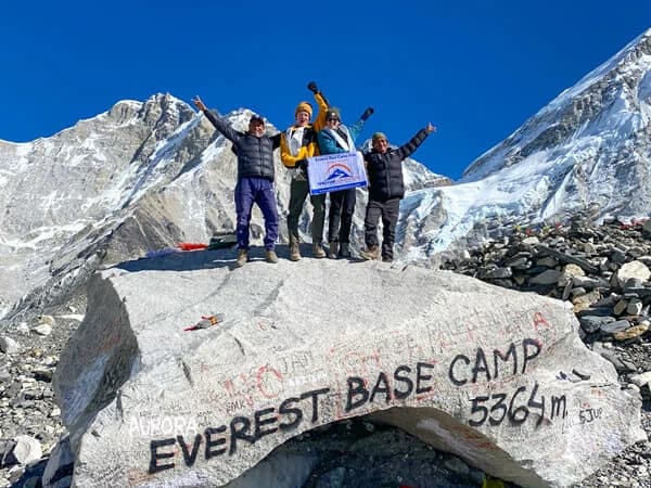
Ask any trekking agency in Kathmandu which route sells out first, and they'll tell you it's this one. The Everest Base Camp Trek runs 10 to 14 days from Lukla to the foot of Everest at 5,364 m, passing through Namche Bazaar and Tengboche along the way. It's the most walked trail in the park and the go-to pick for first-time Himalayan trekkers.
Duration: 10 to 14 days
Difficulty: Moderate to challenging
Max altitude: 5,644 m (18,516 ft) at Kala Patthar
Route highlights: Lukla, Namche Bazaar, Tengboche, Dingboche, Gorak Shep, and Everest Base Camp at around 5,364 m
Best for: First-time Himalayan trekkers
Gokyo Lakes Trek
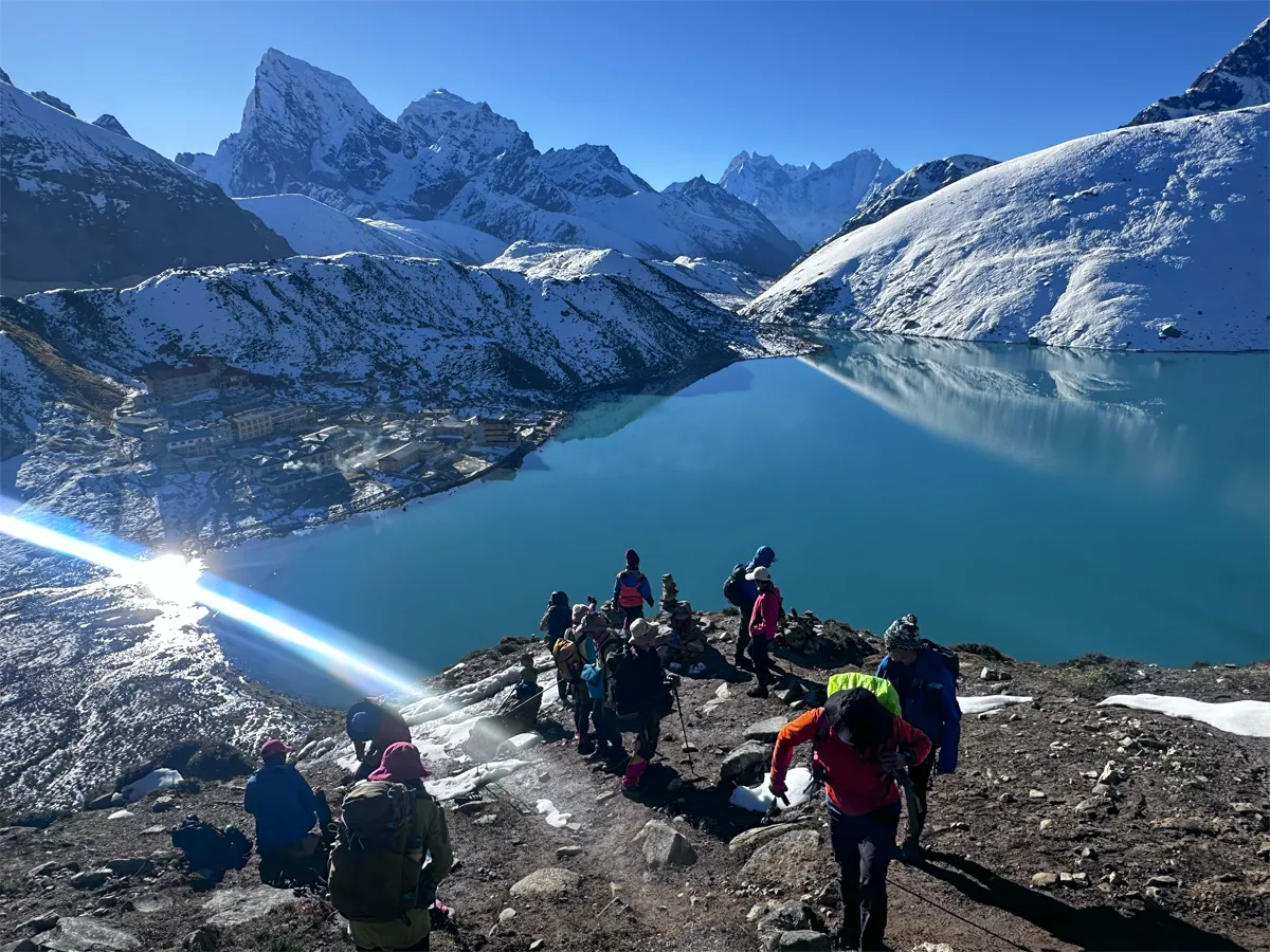
Gokyo Lakes trek in Sagarmatha National Park
Want the same mountain views without sharing the trail with quite so many people? The Gokyo Lakes Trek runs 12 to 16 days, splitting off from the main Everest trail at Namche Bazaar and heading toward six turquoise glacial lakes and the Ngozumpa Glacier. It's a good fit for trekkers who'd rather trade a bit of foot traffic for a quieter version of the same scenery.
Duration: 12 to 16 days
Difficulty: Moderate to challenging
Max altitude: 5,357 m (17,575 ft) at Gokyo Ri
Route highlights: Follows the EBC route to Namche Bazaar, then branches west to the six turquoise Gokyo Lakes and the Ngozumpa Glacier, Nepal's largest glacier
Best for: Trekkers who want fewer crowds without giving up big mountain views
Three Passes Trek
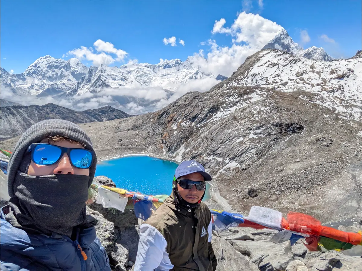
Everest Three High Passes trek route
This one is not for a first trek. The Three Passes Trek is an 18 to 21 day circuit crossing Kongma La, Cho La, and Renjo La, stitching together Everest Base Camp and the Gokyo Lakes into a single loop. It's the toughest route the park has to offer, and it rewards trekkers who already have some high-altitude experience under their belt.
Duration: 18 to 21 days
Difficulty: Very challenging
Max altitude: 5,644 m (18,516 ft), crossing Kongma La (5,535 m), Cho La (5,420 m), and Renjo La (5,360 m)
Route highlights: Links Everest Base Camp, the Gokyo Lakes, and remote side valleys into one continuous circuit
Best for: Experienced, well-acclimatized trekkers who want the full Khumbu circuit
Alternative Overland Approach
Not keen on the Lukla flight? You're not alone, it's notoriously weather-dependent. The overland alternative swaps the flight for a drive from Kathmandu to Phaplu, then a walk through Paiyun to Phakding, where you rejoin the main trail. It costs you extra days on foot, but it takes flight cancellations out of the equation entirely.
Route: Drive from Kathmandu to Phaplu, continue to Paiyun, then hike to Phakding to join the main trail
Why choose it: Avoids the Lukla flight, which is prone to weather delays
Trade-off: Adds several days of walking before reaching the standard EBC route
Best Time to Visit Sagarmatha National Park
If clear skies matter to you, and for most visitors they do, aim for spring (March to May) or autumn (September to November). Autumn tends to edge out spring for sheer visibility, though spring makes up for it with rhododendron forests in full bloom.
Winter is cold, with snow settling in at higher elevations, but the lower villages remain reachable. Summer, or monsoon season, is the one to avoid if views are the priority. Rain and cloud cover roll in and visibility takes a real hit.
Visitor Regulations and Entry Permits
Entry isn't automatic. Every visitor needs a Sagarmatha National Park Entry Permit plus a Khumbu Pasang Lhamu Rural Municipality permit. These local permits replaced the old TIMS card system a few years back, and they're now simply how you get into the Khumbu region.
Permit
Foreign Nationals
SAARC Nationals
Nepali Citizens
Sagarmatha National Park Entry Permit
NPR 3,000
NPR 1,500
NPR 100
Khumbu Pasang Lhamu Rural Municipality Permit
NPR 3,000
NPR 2,000
Local rules apply
Beyond the paperwork, a few conservation rules apply to everyone: stick to marked trails, leave wildlife undisturbed, carry your waste back out, and be mindful of Sherpa customs around monasteries and prayer sites.
Conservation Efforts
Nepal's Department of National Parks and Wildlife Conservation runs the park, but not alone. Its partnership with local Sherpa communities has held the balance between tourism growth and environmental protection for nearly five decades now, which is longer than most conservation models manage to last.
On the ground, that means reforestation work, waste management along the busier trails, and active protection for endangered species like the snow leopard and red panda. The 2002 buffer zone extends those same efforts into the surrounding farmland and forest, taking some of the pressure off the core park itself.
Responsible Tourism in Sagarmatha National Park
Extreme altitude and a living culture make this a place where responsible travel counts for more than usual. A reusable water bottle instead of plastic, a local guide or porter hired instead of skipped, sticking to the marked trail instead of cutting corners, small choices like these add up fast at this scale of foot traffic.
The same goes for how you treat the culture itself. Respect the monasteries, ask before pointing a camera at someone, and spend your money at local teahouses and shops. That's how tourism revenue actually stays in the communities keeping this park running.
Accessibility and Visitor Centers
Getting in means flying from Kathmandu to Lukla, then walking for several days, since no road touches the park's interior. Once you're there, Namche Bazaar's visitor center is worth a stop, with exhibits covering local wildlife, geography, and Sherpa culture.
No vehicles can follow you in, and the terrain is genuinely tough on anyone with mobility limitations, so it's worth being honest with yourself about fitness before you commit. That said, teahouse lodging and basic food services line the main routes the whole way through.
Namche Bazaar, gateway to Sagarmatha National Park
Photography in Sagarmatha National Park
Bring extra memory cards. Sunrise over Everest from Kala Patthar, the turquoise water at Gokyo, the prayer flags strung across Tengboche Monastery's courtyard, these are some of the most photographed scenes anywhere in the Himalayas, and once you're standing there, you'll see why.
Time your shots for early morning or late afternoon. Midday sun flattens the mountain detail and washes everything out. One more thing worth knowing: cold temperatures chew through camera batteries fast at this altitude, so pack spares and keep them warm in an inner pocket.
Frequently Asked Questions
Why is it called Sagarmatha National Park?
It comes from two Nepali words, sagar (sky) and matha (forehead), which together roughly mean "Forehead of the Sky." That's also the official Nepali name for Mount Everest itself, so the park simply borrows its name from the mountain at its center.
What is Sagarmatha National Park known for?
Mostly, it's the gateway to Mount Everest, the tallest mountain on Earth, and that alone would be enough. But visitors keep coming back for the turquoise Gokyo Lakes, the Sherpa culture and monasteries like Tengboche, and a chance, however slim, of spotting a snow leopard or red panda.
When did Sagarmatha National Park become a UNESCO World Heritage Site?
1979, just three years after Nepal established it. UNESCO cited the park's exceptional natural beauty, its dramatic elevation range, and an ecosystem found nowhere else at that altitude.
How big is Sagarmatha National Park?
1,148 square kilometers (443 square miles), plus a 275-square-kilometer buffer zone tacked on in 2002 to protect the land just outside the core park.
What animals live in Sagarmatha National Park?
Snow leopards, red pandas, Himalayan tahr, musk deer, and Himalayan black bears all call it home, alongside more than 118 bird species, including the strikingly colorful Himalayan monal.
Do I need a permit to enter Sagarmatha National Park?
Yes, two permits, actually: a Sagarmatha National Park Entry Permit and a Khumbu Pasang Lhamu Rural Municipality permit. You can pick both up in Kathmandu or at checkpoints near the park entrance.
What is the best time to visit Sagarmatha National Park?
Spring (March to May) or autumn (September to November) are your best bets for clear skies and steady weather. Autumn usually wins out for sheer mountain visibility.
Do I still need a TIMS card to enter the park?
No, that system is gone. The local municipality permit replaced it, and that's what you'll need now to enter the Khumbu region.
Is Sagarmatha National Park accessible without trekking?
Not really. No roads reach the interior, so getting to most of what makes the park worth visiting, Namche Bazaar and Tengboche included, means flying to Lukla and walking the rest.
Who lives inside Sagarmatha National Park?
The Sherpa people do, in villages like Namche Bazaar, Khumjung, Pangboche, and Tengboche. Unlike a lot of protected areas that push residents out, this park lets them stay, farming and grazing livestock right alongside its conservation rules.
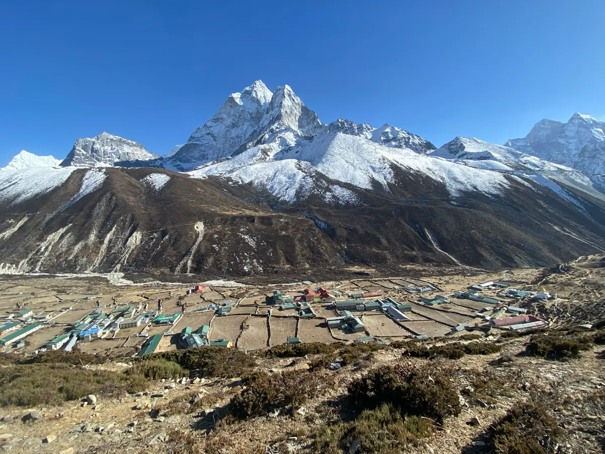
Dingboche village, Khumbu region
The Lasting Pull of Sagarmatha National Park
There's a moment on nearly every trail here, right where the path bends around a ridge, when Everest suddenly fills the view. Vast, silent, and utterly indifferent to how far you traveled to see it. That single moment is, honestly, why people cross oceans for this.
No photo really captures what it feels like to stand beneath the highest point on Earth, glaciers older than memory stretching out around you. But the park is more than its summit. Prayer flags splash color across gray stone, and the quiet resilience of the Sherpa people, who've made a life in this unforgiving terrain for generations, meets every visitor with a warm teahouse and an open door.
It's milk tea after a brutal climb. Frost crunching underfoot at dawn. A kind of silence you only find above 5,000 meters. Whatever pulls you here, the glaciers, the wildlife, the culture, or the mountain itself, Sagarmatha National Park has a way of resetting your sense of scale, one breath and one sunrise at a time.